
filter
-
Brand
- By Category
- Direction
- Date Range
135Events
Pictures
Events

Editorial Shir Hever, Specialist in Pegasus., Barcelona, Spain - 15 Feb 2024
- 2024-02-16
- 10
Editorial Shir Hever, Specialist in Pegasus., Barcelona, Spain - 15 Feb 2024
- 2023-06-15
- 1
Editorial Shir Hever, Specialist in Pegasus., Barcelona, Spain - 15 Feb 2024
- 2023-06-15
- 1
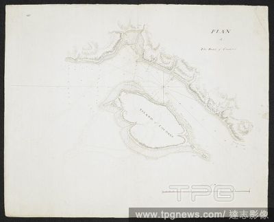
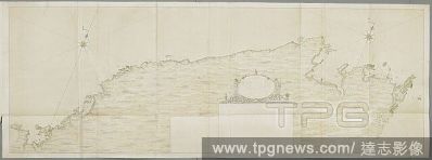
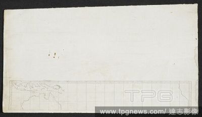
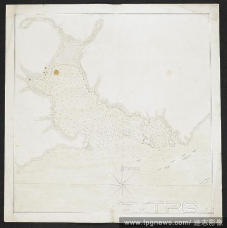
Editorial Plan of the road of Coudres. Shows the island of Coudres. SIXTY-SEVEN Charts and maps illustrating the voyages and surveys of Capt. James Cook, R.N., and other discoverers; circ. 1760- 1780. c 1760-1780. Source: Add. 31360, no.25.
- 2022-12-24
- 1
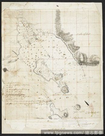
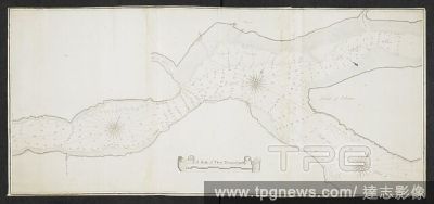
Editorial A plan of the harbour of ST Peters off S. Coast Newfoundland Low water soundings. References to: A. Stagins for splitting & salting fish B. Warfes C. Beach for drying fish(Symbol): rock above water(symbol): rock under water Shows Isle Dogs; Boar I...
- 2022-12-24
- 1

Editorial Chart of the Islands of St Pierre and Miquelon, just off the coast of Newfoundland. SIXTY-SEVEN Charts and maps illustrating the voyages and surveys of Capt. James Cook, R.N., and other discoverers; circ. 1760- 1780. 1763. Source: Add. 31360, no.21.
- 2022-12-24
- 1
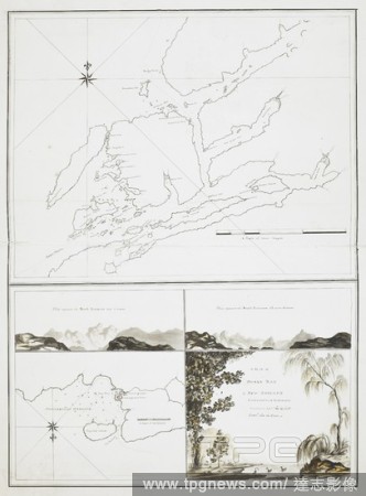
Editorial Chart of Gardiners island and Plum island situated off the coast of America. SIXTY-SEVEN Charts and maps illustrating the voyages and surveys of Capt. James Cook, R.N., and other discoverers; circ. 1760- 1780. c 1760-1780. Source: Add. 31360, no.27.
- 2022-12-24
- 1

Editorial Quebec Harbour River St. Lawrence to “ A scale of Three Thousand Yards” Shows Island of Orleans, N & S Channels of Orleans and full soundings. . SIXTY-SEVEN Charts and maps illustrating the voyages and surveys of Capt. James Cook, R.N., and other...
- 2022-12-24
- 1
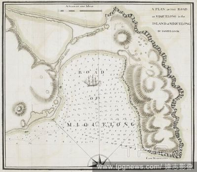
Editorial A plan of the road of Miquelong in the island of Miquelong by James Cook. A scale of one mile. Sixty-Seven Charts and maps illustrating the voyages and surveys of Capt. James Cook, R.N., and other discoverers. circa 1760-1780. Source: Add. 31360, No.15.
- 2022-12-24
- 1
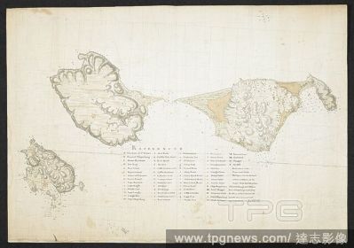
Editorial Coloured plan of Cornwallis Island with ink detail of the town of Halifax with lettered explanation including North & South suburbs, fathoms marked. . SIXTY-SEVEN Charts and maps illustrating the voyages and surveys of Capt. James Cook, R.N., and othe...
- 2022-12-24
- 1
Editorial Chart of a coastline, with the words in the margin, 'geo. Vancouver'. SIXTY-SEVEN Charts and maps illustrating the voyages and surveys of Capt. James Cook, R.N., and other discoverers; circ. 1760- 1780. c 1760-1780. Source: Add. 31360, no.42.
- 2022-12-24
- 1
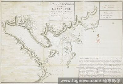
Editorial A plan of York harbour (also known as Chateaux Bay) on the coast of Labradore. Commissioned by Thomas Graves, Governor of Newfoundland from 1761 to 1764 , and completed by James Cook in 1763. Sixty-Seven Charts and maps illustrating the voyages and sur...
- 2022-12-24
- 1
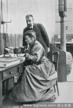
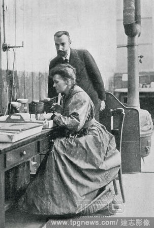
Editorial CURIE, Pierre (Paris, 1859-1906); Marie (Warsaw, 1867-Sallanches, 1934). French physicists. Discoverers of the radium in 1898. They received the Nobel Prize in Chemistry in 1903. Portrait of Pierre and Marie in the laboratory. YEAR 1904.
- 2022-12-24
- 1

Editorial Daily Life In Lisbon Amid COVID-19 Pandemic, Portugal - 29 Jan 2022
- 2022-02-06
- 14

Editorial Platinum Jubilee
- 2022-02-05
- 1
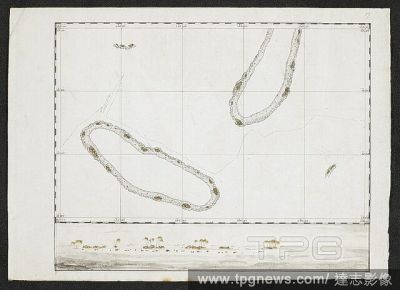
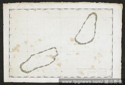
Editorial A chart showing two islands. SIXTY-SEVEN Charts and maps illustrating the voyages and surveys of Capt. James Cook, R.N., and other discoverers; circ. 1760- 1780. c 1760-1780. Source: Add. 31360, no.57.
- 2022-01-18
- 1
Editorial A plan of Dusky Bay in New Zealand. Sixty-Seven Charts and maps illustrating the voyages and surveys of Capt. James Cook, R.N., and other discoverers. circa 1760-1780. Source: Add. 31360, No.55.
- 2022-01-18
- 1
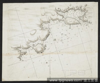
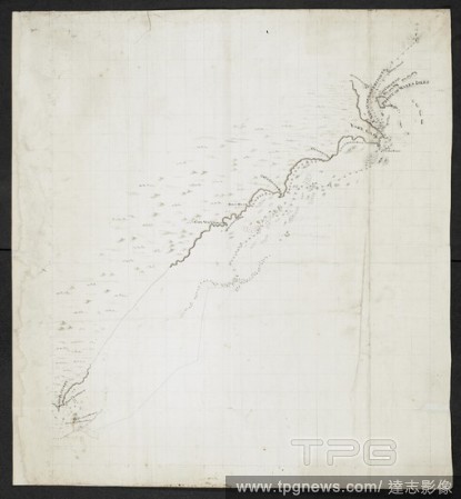
Editorial A chart showing coastlines. SIXTY-SEVEN Charts and maps illustrating the voyages and surveys of Capt. James Cook, R.N., and other discoverers; circ. 1760- 1780. c 1760-1780. Source: Add. 31360, no.28.
- 2022-01-18
- 1

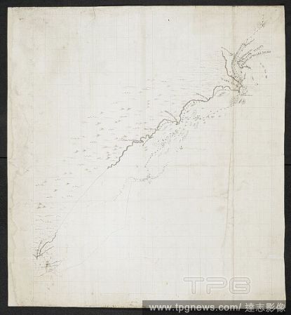
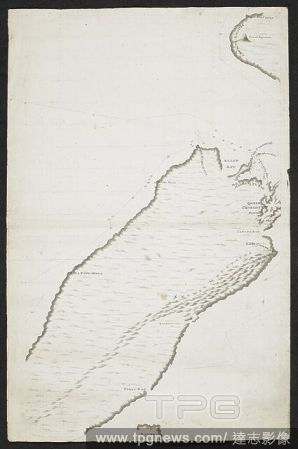
Editorial Chart of the coast of New South Wales, Australia, from Point Hicks to Smoky Cape, made during Captain Cook's First Voyage. Charts and maps illustrating the voyages and surveys of Capt. James Cook and other discoverers. 1770. Source: Add. 31360, No.45. ...
- 2022-01-18
- 1
Editorial Chart of the north east coast of Australia, from Cape York to Cape Flattery. SIXTY-SEVEN Charts and maps illustrating the voyages and surveys of Capt. James Cook, R.N., and other discoverers; circ. 1760- 1780. c 1760-1780. Source: Add. 31360, no.46.
- 2022-01-18
- 1

Editorial A chart of the Bay of Plenty, New Zealand, from Cape Runaway to Cape Colvill. Made during Captain Cook's First Voyage, after November 1769. Charts and maps illustrating the voyages and surveys of Captain James Cook and other discoverers. 1769-1770. Sou...
- 2022-01-18
- 1
Editorial Chart of the Islands of St Pierre and Miquelon, just off the coast of Newfoundland. SIXTY-SEVEN Charts and maps illustrating the voyages and surveys of Capt. James Cook, R.N., and other discoverers; circ. 1760- 1780. 1763. Source: Add. 31360, no.21.
- 2022-01-18
- 2

Editorial Chart of Gardiners island and Plum island situated off the coast of America. SIXTY-SEVEN Charts and maps illustrating the voyages and surveys of Capt. James Cook, R.N., and other discoverers; circ. 1760- 1780. c 1760-1780. Source: Add. 31360, no.27.
- 2022-01-18
- 1
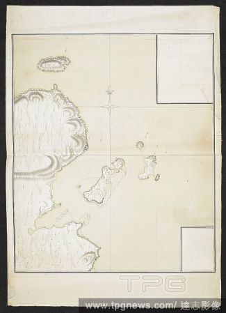
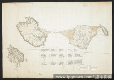
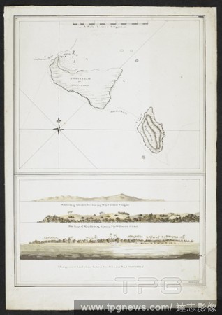
Editorial Chart showing two islands, Amsterdam or Tongataboo, and, Middleburg. Landscape views of Middleburg and Van Diemans, Amsterdam. Tongatapu is the main island of the Kingdom of Tonga. The Resolution stopped here in 1777 under Captain Cook. . SIXTY-SEVEN...
- 2022-01-18
- 1
Editorial Chart showing part of the northisland of New Zealand. The two capes are indicated, Cape Teerawhitte and Palliser. SIXTY-SEVEN Charts and maps illustrating the voyages and surveys of Capt. James Cook, R.N., and other discoverers; circ. 1760- 1780. c 176...
- 2022-01-18
- 1
Editorial Chart showing part of South island, New Zealand. Dusky bay is indicated. SIXTY-SEVEN Charts and maps illustrating the voyages and surveys of Capt. James Cook, R.N., and other discoverers; circ. 1760- 1780. c 1760-1780. Source: Add. 31360, no.47.
- 2022-01-18
- 1
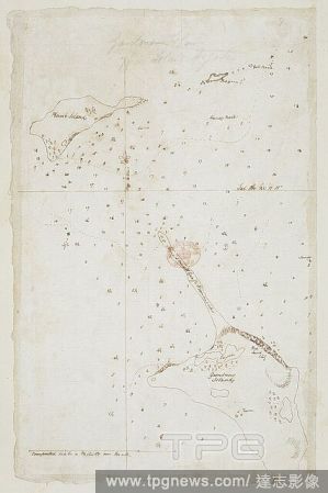
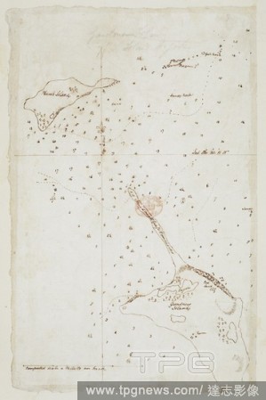
Editorial Chart with notes. SIXTY-SEVEN Charts and maps illustrating the voyages and surveys of Capt. James Cook, R.N., and other discoverers; circ. 1760- 1780. c 1760-1780. Source: Add. 31360, no.12.
- 2022-01-18
- 1
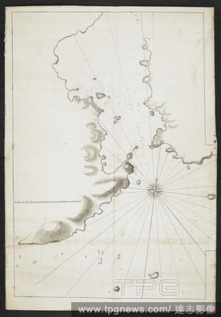
Editorial Chart of a coastline and islands. SIXTY-SEVEN Charts and maps illustrating the voyages and surveys of Capt. James Cook, R.N., and other discoverers; circ. 1760- 1780. c 1760-1780. Source: Add. 31360, no.22.
- 2022-01-18
- 1

Editorial A chart showing parts of New Zealand, including Dusky Bay. SIXTY-SEVEN Charts and maps illustrating the voyages and surveys of Capt. James Cook, R.N., and other discoverers; circ. 1760- 1780. 1773. Source: Add. 31360, no.56.
- 2022-01-18
- 1

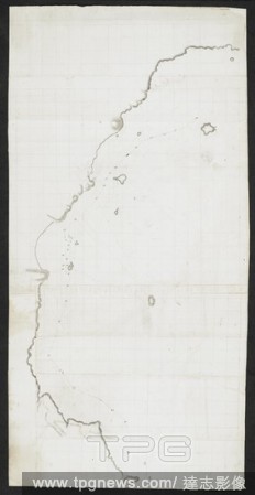
Editorial Chart of a coastline. SIXTY-SEVEN Charts and maps illustrating the voyages and surveys of Capt. James Cook, R.N., and other discoverers; circ. 1760- 1780. c 1760-1780. Source: Add. 31360, no.53.
- 2022-01-18
- 1
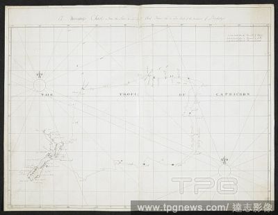
Editorial A Mercators chart. 'The tropic of Capricorn.' The cart shows New Zealand. . SIXTY-SEVEN Charts and maps illustrating the voyages and surveys of Capt. James Cook, R.N., and other discoverers; circ. 1760- 1780. c 1760-1780. Source: Add. 31360, no.1.
- 2022-01-18
- 1
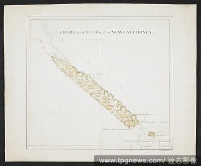
Editorial Chart of the N.E. coast of New Caledonia. SIXTY-SEVEN Charts and maps illustrating the voyages and surveys of Capt. James Cook, R.N., and other discoverers; circ. 1760- 1780. c 1760-1780. Source: Add. 31360, no.40.
- 2022-01-18
- 1

Editorial Coloured plan of Cornwallis Island with ink detail of the town of Halifax with lettered explanation including North & South suburbs, fathoms marked. . SIXTY-SEVEN Charts and maps illustrating the voyages and surveys of Capt. James Cook, R.N., and othe...
- 2022-01-18
- 1
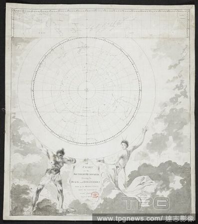
Editorial Chart of the southern hemisphere shewing the track and discoveries made by the Resolution under the command of Capt. Cook, 1772.3.4& 5. SIXTY-SEVEN Charts and maps illustrating the voyages and surveys of Capt. James Cook, R.N., and other discoverers; c...
- 2022-01-18
- 1

Editorial Chart of a coastline, with the words in the margin, 'geo. Vancouver'. SIXTY-SEVEN Charts and maps illustrating the voyages and surveys of Capt. James Cook, R.N., and other discoverers; circ. 1760- 1780. c 1760-1780. Source: Add. 31360, no.42.
- 2022-01-18
- 1

Editorial Chart showing the part of the coast of South America. SIXTY-SEVEN Charts and maps illustrating the voyages and surveys of Capt. James Cook, R.N., and other discoverers; circ. 1760- 1780. c 1760-1780. Source: Add. 31360, no.29.
- 2022-01-18
- 1

Editorial A plan of York harbour (also known as Chateaux Bay) on the coast of Labradore. Commissioned by Thomas Graves, Governor of Newfoundland from 1761 to 1764 , and completed by James Cook in 1763. Sixty-Seven Charts and maps illustrating the voyages and sur...
- 2022-01-18
- 1
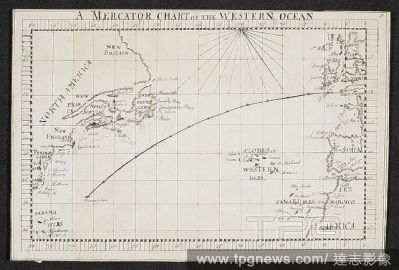
Editorial A mercator chart of the western ocean. SIXTY-SEVEN Charts and maps illustrating the voyages and surveys of Capt. James Cook, R.N., and other discoverers; circ. 1760- 1780. c 1760-1780. Source: Add. 31360, no.
- 2022-01-18
- 1
Editorial Chart showing a coastline and natives. SIXTY-SEVEN Charts and maps illustrating the voyages and surveys of Capt. James Cook, R.N., and other discoverers; circ. 1760- 1780. c 1760-1780. Source: Add. 31360, no.11.
- 2022-01-18
- 1
Editorial Chart of the N.E. coast of New Caledonia. SIXTY-SEVEN Charts and maps illustrating the voyages and surveys of Capt. James Cook, R.N., and other discoverers; circ. 1760- 1780. c 1760-1780. Source: Add. 31360, no.41.
- 2022-01-18
- 1

Editorial A chart showing coastlines and islands. SIXTY-SEVEN Charts and maps illustrating the voyages and surveys of Capt. James Cook, R.N., and other discoverers; circ. 1760- 1780. c 1760-1780. Source: Add. 31360, no.23.
- 2022-01-18
- 1

Editorial A chart showing four islands. SIXTY-SEVEN Charts and maps illustrating the voyages and surveys of Capt. James Cook, R.N., and other discoverers; circ. 1760- 1780. c 1760-1780. Source: Add. 31360, no.37.
- 2022-01-18
- 1
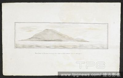
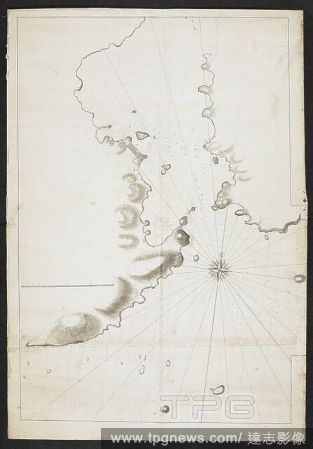
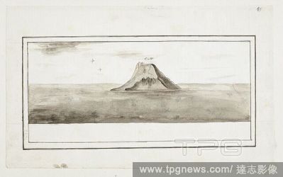
Editorial The island of Palma bearing from east to S.S.E distant about 4 leagues. SIXTY-SEVEN Charts and maps illustrating the voyages and surveys of Capt. James Cook, R.N., and other discoverers; circ. 1760- 1780. c 1760-1780. Source: Add. 31360, no.58.
- 2022-01-18
- 1

Editorial Plan of the road of Coudres. Shows the island of Coudres. SIXTY-SEVEN Charts and maps illustrating the voyages and surveys of Capt. James Cook, R.N., and other discoverers; circ. 1760- 1780. c 1760-1780. Source: Add. 31360, no.25.
- 2022-01-18
- 2
Editorial Chart of the southern hemisphere. SIXTY-SEVEN Charts and maps illustrating the voyages and surveys of Capt. James Cook, R.N., and other discoverers; circ. 1760- 1780. c 1760-1780. Source: Add. 31360, no.6.
- 2022-01-18
- 1

Editorial Chart of Botany Bay, made during Captain Cook's First Voyage. After April 1770. Charts and maps illustrating the voyages and surveys of Captain James Cook and other discoverers. 1770. Source: Add. 31360, No.33. Language: English.
- 2022-01-18
- 1
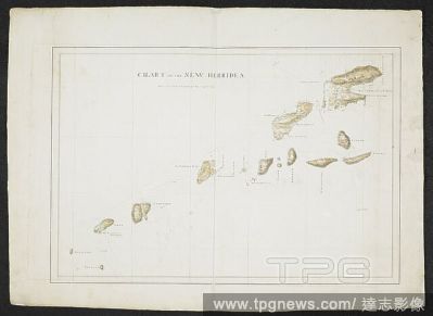
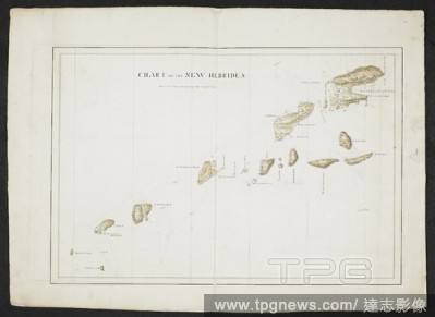
Editorial Chart of the New Hebrides, as named by Captain Cook, the island group in the south Pacific ocean, now the nation of Vanuatu. SIXTY-SEVEN Charts and maps illustrating the voyages and surveys of Capt. James Cook, R.N., and other discoverers; circ. 1760- ...
- 2022-01-18
- 1
Editorial A small island. SIXTY-SEVEN Charts and maps illustrating the voyages and surveys of Capt. James Cook, R.N., and other discoverers; circ. 1760- 1780. c 1760-1780. Source: Add. 31360, no.59.
- 2022-01-18
- 1

Editorial A plan of the harbour of ST Peters off S. Coast Newfoundland Low water soundings. References to: A. Stagins for splitting & salting fish B. Warfes C. Beach for drying fish(Symbol): rock above water(symbol): rock under water Shows Isle Dogs; Boar I...
- 2022-01-18
- 1

Editorial Chart of a coastline. SIXTY-SEVEN Charts and maps illustrating the voyages and surveys of Capt. James Cook, R.N., and other discoverers; circ. 1760- 1780. c 1760-1780. Source: Add. 31360, no.16.
- 2022-01-18
- 1

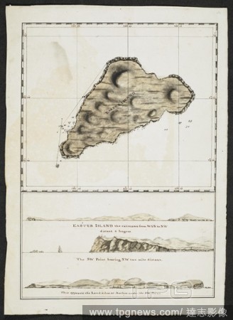
Editorial Chart and drawings of Easter island. SIXTY-SEVEN Charts and maps illustrating the voyages and surveys of Capt. James Cook, R.N., and other discoverers; circ. 1760- 1780. c 1760-1780. Source: Add. 31360, no.34.
- 2022-01-18
- 1

Editorial A chart showing a coastline. SIXTY-SEVEN Charts and maps illustrating the voyages and surveys of Capt. James Cook, R.N., and other discoverers; circ. 1760- 1780. c 1760-1780. Source: Add. 31360, no.39.
- 2022-01-18
- 1
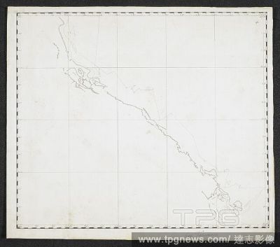
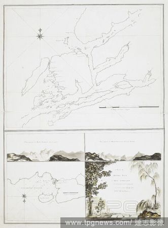
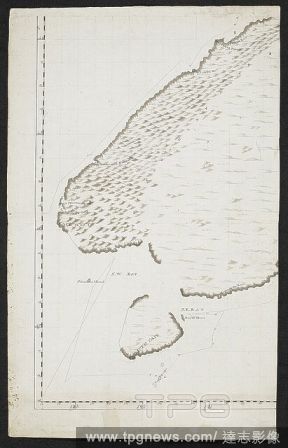
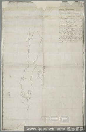
Editorial Chart of South island, New Zealand. SIXTY-SEVEN Charts and maps illustrating the voyages and surveys of Capt. James Cook, R.N., and other discoverers; circ. 1760- 1780. c 1760-1780. Source: Add. 31360, no.51.
- 2022-01-18
- 2
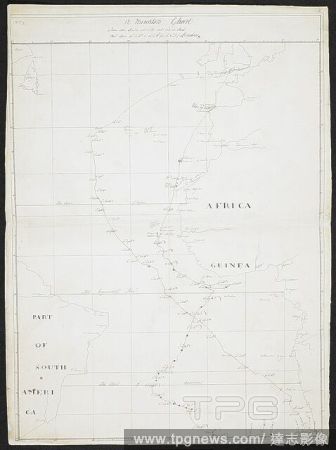
Editorial A Mercator's chart. 'Africa'. 'Guinea.' 'Part of South America.'. SIXTY-SEVEN Charts and maps illustrating the voyages and surveys of Capt. James Cook, R.N., and other discoverers; circ. 1760- 1780. c 1760-1780. Source: Add. 31360, no.2.
- 2022-01-18
- 1

Editorial Map of Botany Bay in New South Wales, made during Captain Cook's First Voyage. Charts and maps illustrating the voyages and surveys of Captain James Cook and other discoverers. 1770. Source: Add. 31360, No.32. Language: English.
- 2022-01-18
- 1
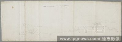
Editorial Top of a chart. SIXTY-SEVEN Charts and maps illustrating the voyages and surveys of Capt. James Cook, R.N., and other discoverers; circ. 1760- 1780. c 1760-1780. Source: Add. 31360, no.31.
- 2022-01-18
- 1
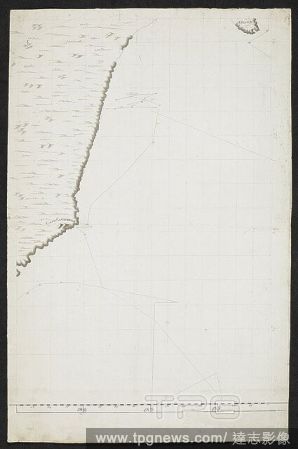
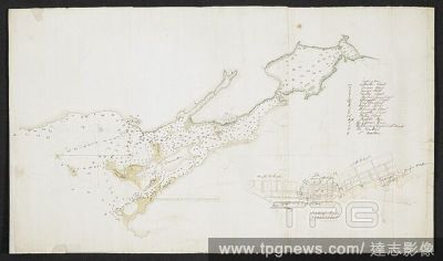
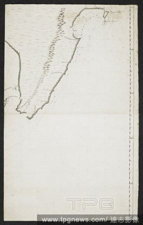
Editorial Chart showing part of the coastline of South island, New Zealand. Cape Saunders is indicated. SIXTY-SEVEN Charts and maps illustrating the voyages and surveys of Capt. James Cook, R.N., and other discoverers; circ. 1760- 1780. c 1760-1780. Source: Add....
- 2022-01-18
- 2
Editorial Quebec Harbour River St. Lawrence to “ A scale of Three Thousand Yards” Shows Island of Orleans, N & S Channels of Orleans and full soundings. . SIXTY-SEVEN Charts and maps illustrating the voyages and surveys of Capt. James Cook, R.N., and other...
- 2022-01-18
- 1

Editorial Chart of the Bay of Plenty, New Zealand, from Cape Colvill to Poverty Bay. Made during Captain Cook's First Voyage, after November 1769. Charts and maps illustrating the voyages and surveys of Captain James Cook and other discoverers. 1769-1770. Source...
- 2022-01-18
- 2
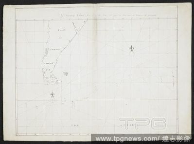
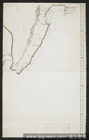
Editorial Chart of part of the coast ... Great Andaman ... islands. SIXTY-SEVEN Charts and maps illustrating the voyages and surveys of Capt. James Cook, R.N., and other discoverers; circ. 1760- 1780. c 1760-1780. Source: Add. 31360, no.30.
- 2022-01-18
- 1
Editorial A chart showing a coastline. SIXTY-SEVEN Charts and maps illustrating the voyages and surveys of Capt. James Cook, R.N., and other discoverers; circ. 1760- 1780. c 1760-1780. Source: Add. 31360, no.38.
- 2022-01-18
- 2
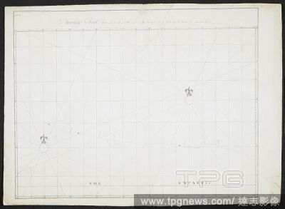
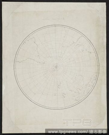
Editorial A mercator's chart. 'The Antartic.'. SIXTY-SEVEN Charts and maps illustrating the voyages and surveys of Capt. James Cook, R.N., and other discoverers; circ. 1760- 1780. c 1760-1780. Source: Add. 31360, no.4.
- 2022-01-18
- 1
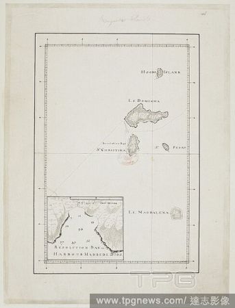
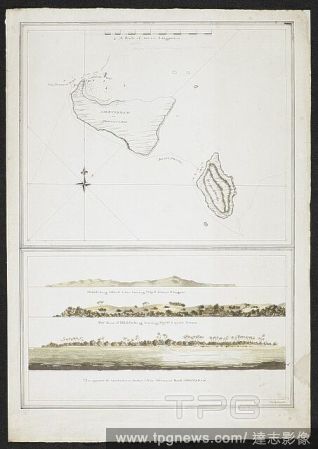
Editorial Chart of the Marquesas (Te Henua) islands. Named on the chart as: Hoods island (Hood's island - ); Le Dominica (Dominica - Hiva Oa); St. Christina, showing Resolution bay (Santa Cristina - Tahuata); St. Pedro (San Pedro - Moho Tani); and, Le Magdalena ...
- 2022-01-18
- 1
Editorial A Mercators chart. 'Part of South America'. 'The Antartic.'. SIXTY-SEVEN Charts and maps illustrating the voyages and surveys of Capt. James Cook, R.N., and other discoverers; circ. 1760- 1780. c 1760-1780. Source: Add. 31360, no.5.
- 2022-01-18
- 1
Editorial Chart of a coastline and islands. SIXTY-SEVEN Charts and maps illustrating the voyages and surveys of Capt. James Cook, R.N., and other discoverers; circ. 1760- 1780. c 1760-1780. Source: Add. 31360, no.19.
- 2022-01-18
- 1
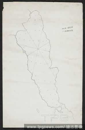
Editorial Chart with the name 'Paradise harbour.'. SIXTY-SEVEN Charts and maps illustrating the voyages and surveys of Capt. James Cook, R.N., and other discoverers; circ. 1760- 1780. c 1760-1780. Source: Add. 31360, no.17.
- 2022-01-18
- 1
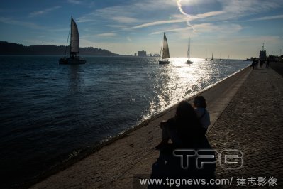
Editorial Daily Life In Lisbon Amid COVID-19 Pandemic, Portugal - 19 Oct 2021
- 2021-10-24
- 4

Editorial Amfar Gala Against Aids, Antibes - 21 May 2009
- 2021-08-18
- 1
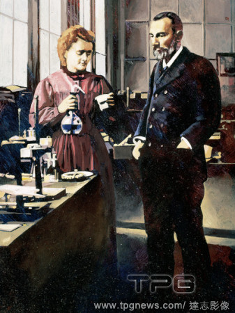
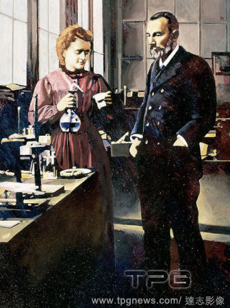
Editorial Pierre Curie (1859-1906) and Marie Curie (1867-1934). French physicists. Discoverers of radium in 1898. Nobel Prize in Chemistry in 1903.
- 2020-11-30
- 1

Editorial Chart of Botany Bay, made during Captain Cook's First Voyage. After April 1770. Charts and maps illustrating the voyages and surveys of Captain James Cook and other discoverers. 1770. Source: Add. 31360, No.33. Language: English.
- 2020-11-26
- 1

Editorial Chart of the coast of New South Wales, Australia, from Point Hicks to Smoky Cape, made during Captain Cook's First Voyage. Charts and maps illustrating the voyages and surveys of Capt. James Cook and other discoverers. 1770. Source: Add. 31360, No.45. ...
- 2020-11-26
- 1

Editorial Chart of the north east coast of Australia, from Cape York to Cape Flattery. SIXTY-SEVEN Charts and maps illustrating the voyages and surveys of Capt. James Cook, R.N., and other discoverers; circ. 1760- 1780. c 1760-1780. Source: Add. 31360, no.46.
- 2020-11-26
- 1
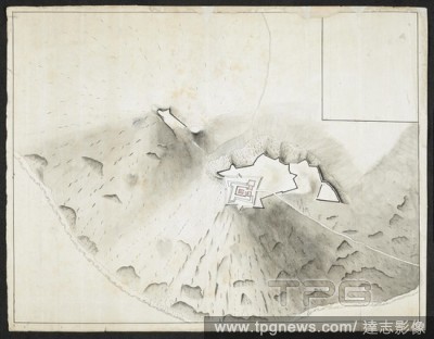
Editorial Sketch of a fortification on a hill. SIXTY-SEVEN Charts and maps illustrating the voyages and surveys of Capt. James Cook, R.N., and other discoverers; circ. 1760- 1780. c 1760-1780. Source: Add. 31360, no.66.
- 2020-09-28
- 1

Editorial Sketch of a fortification on a hill. SIXTY-SEVEN Charts and maps illustrating the voyages and surveys of Capt. James Cook, R.N., and other discoverers; circ. 1760- 1780. c 1760-1780. Source: Add. 31360, no.66.
- 2020-03-25
- 1

Editorial Pierre Curie (1859-1906) and Marie Curie (1867-1934). French physicists. Discoverers of radium in 1898. Nobel Prize in Chemistry in 1903.
- 2019-02-01
- 1
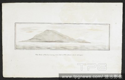
Editorial The island of Palma bearing from east to S.S.E distant about 4 leagues. SIXTY-SEVEN Charts and maps illustrating the voyages and surveys of Capt. James Cook, R.N., and other discoverers; circ. 1760- 1780. c 1760-1780. Source: Add. 31360, no.58.
- 2018-12-06
- 1
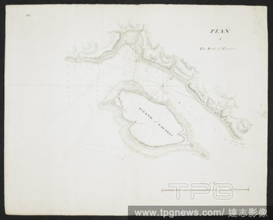
Editorial Plan of the road of Coudres. Shows the island of Coudres. SIXTY-SEVEN Charts and maps illustrating the voyages and surveys of Capt. James Cook, R.N., and other discoverers; circ. 1760- 1780. c 1760-1780. Source: Add. 31360, no.25.
- 2018-12-06
- 2

Editorial Chart of the southern hemisphere. SIXTY-SEVEN Charts and maps illustrating the voyages and surveys of Capt. James Cook, R.N., and other discoverers; circ. 1760- 1780. c 1760-1780. Source: Add. 31360, no.6.
- 2018-12-06
- 1
Editorial Chart of Botany Bay, made during Captain Cook's First Voyage. After April 1770. Charts and maps illustrating the voyages and surveys of Captain James Cook and other discoverers. 1770. Source: Add. 31360, No.33. Language: English.
- 2018-12-06
- 1
Editorial Chart of the New Hebrides, as named by Captain Cook, the island group in the south Pacific ocean, now the nation of Vanuatu. SIXTY-SEVEN Charts and maps illustrating the voyages and surveys of Capt. James Cook, R.N., and other discoverers; circ. 1760- ...
- 2018-12-06
- 1

Editorial A small island. SIXTY-SEVEN Charts and maps illustrating the voyages and surveys of Capt. James Cook, R.N., and other discoverers; circ. 1760- 1780. c 1760-1780. Source: Add. 31360, no.59.
- 2018-12-06
- 2

Editorial A plan of the harbour of ST Peters off S. Coast Newfoundland Low water soundings. References to: A. Stagins for splitting & salting fish B. Warfes C. Beach for drying fish(Symbol): rock above water(symbol): rock under water Shows Isle Dogs; Boar I...
- 2018-12-06
- 1
Editorial Chart of a coastline. SIXTY-SEVEN Charts and maps illustrating the voyages and surveys of Capt. James Cook, R.N., and other discoverers; circ. 1760- 1780. c 1760-1780. Source: Add. 31360, no.16.
- 2018-12-06
- 1

Editorial A chart showing two islands. SIXTY-SEVEN Charts and maps illustrating the voyages and surveys of Capt. James Cook, R.N., and other discoverers; circ. 1760- 1780. c 1760-1780. Source: Add. 31360, no.57.
- 2018-12-06
- 1
Editorial A plan of Dusky Bay in New Zealand. Sixty-Seven Charts and maps illustrating the voyages and surveys of Capt. James Cook, R.N., and other discoverers. circa 1760-1780. Source: Add. 31360, No.55.
- 2018-12-06
- 1
Editorial A chart showing coastlines. SIXTY-SEVEN Charts and maps illustrating the voyages and surveys of Capt. James Cook, R.N., and other discoverers; circ. 1760- 1780. c 1760-1780. Source: Add. 31360, no.28.
- 2018-12-06
- 1

Editorial Chart of the coast of New South Wales, Australia, from Point Hicks to Smoky Cape, made during Captain Cook's First Voyage. Charts and maps illustrating the voyages and surveys of Capt. James Cook and other discoverers. 1770. Source: Add. 31360, No.45. ...
- 2018-12-06
- 1
Editorial Chart of the north east coast of Australia, from Cape York to Cape Flattery. SIXTY-SEVEN Charts and maps illustrating the voyages and surveys of Capt. James Cook, R.N., and other discoverers; circ. 1760- 1780. c 1760-1780. Source: Add. 31360, no.46.
- 2018-12-06
- 1
Editorial A chart of the Bay of Plenty, New Zealand, from Cape Runaway to Cape Colvill. Made during Captain Cook's First Voyage, after November 1769. Charts and maps illustrating the voyages and surveys of Captain James Cook and other discoverers. 1769-1770. Sou...
- 2018-12-06
- 1
Editorial Chart of the Islands of St Pierre and Miquelon, just off the coast of Newfoundland. SIXTY-SEVEN Charts and maps illustrating the voyages and surveys of Capt. James Cook, R.N., and other discoverers; circ. 1760- 1780. 1763. Source: Add. 31360, no.21.
- 2018-12-06
- 2
Editorial Chart of Gardiners island and Plum island situated off the coast of America. SIXTY-SEVEN Charts and maps illustrating the voyages and surveys of Capt. James Cook, R.N., and other discoverers; circ. 1760- 1780. c 1760-1780. Source: Add. 31360, no.27.
- 2018-12-06
- 1
Editorial Chart showing two islands, Amsterdam or Tongataboo, and, Middleburg. Landscape views of Middleburg and Van Diemans, Amsterdam. Tongatapu is the main island of the Kingdom of Tonga. The Resolution stopped here in 1777 under Captain Cook. . SIXTY-SEVEN...
- 2018-12-06
- 1
Editorial Chart showing part of the northisland of New Zealand. The two capes are indicated, Cape Teerawhitte and Palliser. SIXTY-SEVEN Charts and maps illustrating the voyages and surveys of Capt. James Cook, R.N., and other discoverers; circ. 1760- 1780. c 176...
- 2018-12-06
- 1

Editorial Chart showing part of South island, New Zealand. Dusky bay is indicated. SIXTY-SEVEN Charts and maps illustrating the voyages and surveys of Capt. James Cook, R.N., and other discoverers; circ. 1760- 1780. c 1760-1780. Source: Add. 31360, no.47.
- 2018-12-06
- 1

Editorial Chart with notes. SIXTY-SEVEN Charts and maps illustrating the voyages and surveys of Capt. James Cook, R.N., and other discoverers; circ. 1760- 1780. c 1760-1780. Source: Add. 31360, no.12.
- 2018-12-06
- 1
Editorial Chart and drawings of Easter island. SIXTY-SEVEN Charts and maps illustrating the voyages and surveys of Capt. James Cook, R.N., and other discoverers; circ. 1760- 1780. c 1760-1780. Source: Add. 31360, no.34.
- 2018-12-06
- 1

Editorial A chart showing a coastline. SIXTY-SEVEN Charts and maps illustrating the voyages and surveys of Capt. James Cook, R.N., and other discoverers; circ. 1760- 1780. c 1760-1780. Source: Add. 31360, no.39.
- 2018-12-06
- 1
 Loading