
filter
-
Brand
- By Category
- Direction
- Date Range
163Events
Pictures
Events
Editorial
- 2023-11-14
- 1
Editorial
- 2023-11-14
- 1
Editorial
- 2023-11-14
- 1
Editorial
- 2023-11-14
- 1
Editorial
- 2023-11-14
- 1
Editorial
- 2023-06-16
- 1
Editorial
- 2023-06-16
- 1
Editorial
- 2023-06-16
- 1
Editorial
- 2023-06-16
- 1

Editorial
- 2023-06-16
- 1
Editorial
- 2023-06-16
- 1
Editorial
- 2023-06-16
- 1
Editorial
- 2023-06-16
- 1

Editorial
- 2023-06-16
- 1

Editorial
- 2023-06-16
- 1
Editorial
- 2023-06-15
- 1
Editorial
- 2023-06-15
- 1
Editorial
- 2023-06-07
- 1
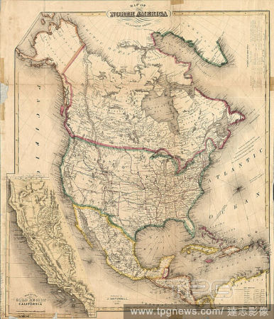
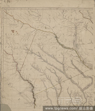
Editorial Map of North America, cartographic, Maps, 1851, Smith, J. Calvin (John Calvin).
- 2022-12-24
- 1
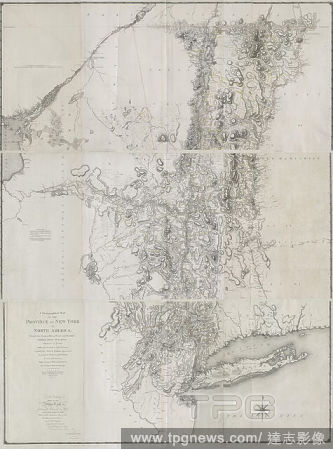
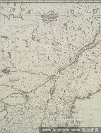
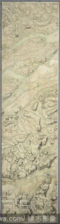
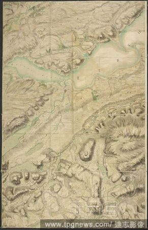
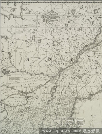
Editorial A chorographical map of the province of New-York in North America, divided into counties, manors, patents and townships : exhibiting likewise all the private grants of land made and located in that Province, cartographic, Maps, 1779, Sauthier, Claude J...
- 2022-12-24
- 1
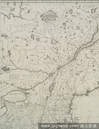
Editorial A map of the British and French dominions in North America : with the roads, distances, limits, and extent of the settlements, humbly inscribed to the Right Honourable the Earl of Halifax, and the other Right Honourable the Lords Commissioners for Trad...
- 2022-12-24
- 1
Editorial Map of post Jacobean Scotland in 1755, 10 years after the Battle of Culloden. The land of Culloden and Inverness. A very large and highly finished colored military survey of the kingdom of Scotland, exclusive of the islands, undertaken by order of Will...
- 2022-01-18
- 1
Editorial Map of post Jacobean Scotland in 1755, 10 years after the Battle of Culloden. The land of Culloden and Inverness. The Roy Map of Scotland. A very large and highly finished colored military survey of the kingdom of Scotland, exclusive of the islands, un...
- 2022-01-18
- 1
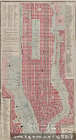
Editorial Map of New York City, cartographic, Maps, 1892.
- 2021-04-07
- 1
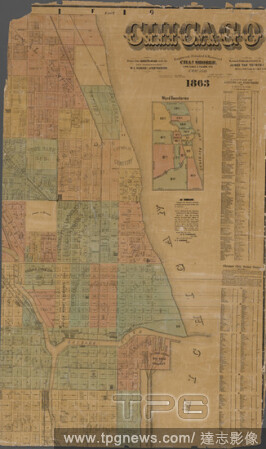
Editorial Chicago , cartographic, Maps, 1863, Van Vechten, J., Charles Shober & Co.
- 2021-04-07
- 1
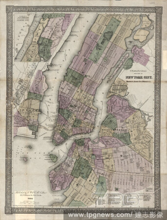
Editorial G. Woolworth's Colton's new Map New York City, Brooklyn, Jersey City, Hoboken, etc., cartographic, Maps, 1866.
- 2021-04-07
- 1
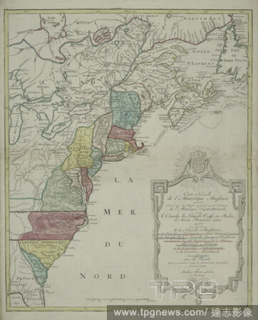
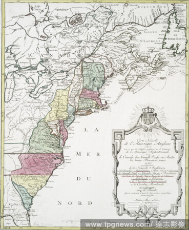
Editorial Carte nouvelle de l'Amerique angloise : contenant tout ce que les Anglois possedent sur le continent de l'Amerique septentrionale savoir le Canada, la Nouvelle Ecosse ou Acadie, les treize provinces unies qui sont: les quatres colonies de la Nouvelle A...
- 2021-04-07
- 2
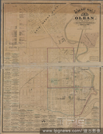
Editorial Map of Olean, New York, cartographic, Maps, 1878, H.J. Toudy & Co.
- 2021-04-07
- 1
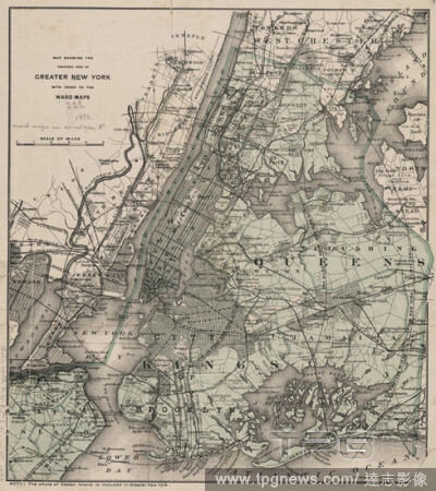
Editorial Map showing the proposed area of Greater New York, with index to the Ward Maps., cartographic, Maps, 1896.
- 2021-04-07
- 1
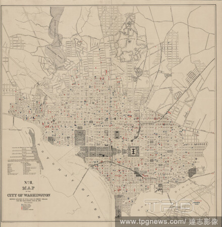
Editorial Map of the city of Washington showing location of fatal cases of zymotic diseases for the year ending June 30, 1895, cartographic, Maps, 1895, Norris Peters Co.
- 2021-04-07
- 1
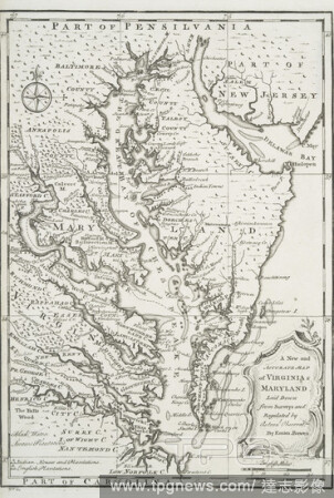
Editorial A new and accurate map of Virginia & Maryland, cartographic, Maps, 1752, Bowen, Emanuel (d. 1767 ).
- 2021-04-07
- 1
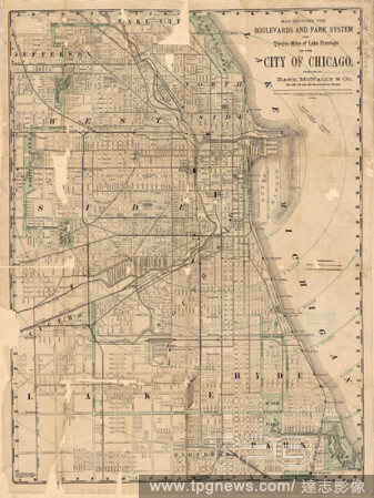
Editorial Map showing the boulevards and park system and twelve miles of lake frontage of the City of Chicago , cartographic, Maps, 1882, Rand McNally and Company, Rand McNally and Company.
- 2021-04-07
- 1
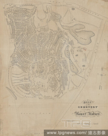
Editorial Plan of the cemetery of Mount Auburn, cartographic, Maps, 1854, Wadsworth, Alexander, 1806-1898, S.W. Chandler & Bro.
- 2021-04-07
- 1
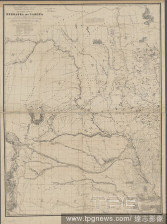
Editorial Military map of Nebraska and Dakota , cartographic, Maps, 1857, Warren, G. K. (Gouverneur Kemble), 1830-1882, Floyd, John B. (John Buchanan), 1806-1863, Harney, William S. (William Selby), 1800-1889, Humphreys, A. A. (Andrew Atkinson), 1810-1883, Lewis...
- 2021-04-07
- 1
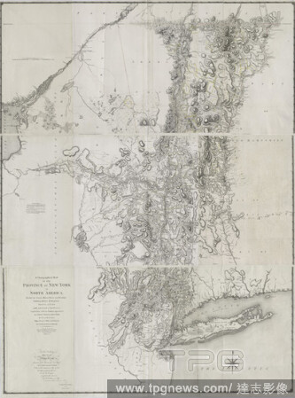
Editorial A chorographical map of the province of New-York in North America, divided into counties, manors, patents and townships : exhibiting likewise all the private grants of land made and located in that Province, cartographic, Maps, 1779, Sauthier, Claude J...
- 2021-04-07
- 2
Editorial Carte nouvelle de l'Amerique angloise : contenant tout ce que les Anglois possedent sur le continent de l'Amerique septentrionale voir le Canada, la Nouvelle Ecosse ou Acadie, les treize provinces unies qui sont: les quatres colonies de la Nouvelle Ang...
- 2021-04-07
- 2
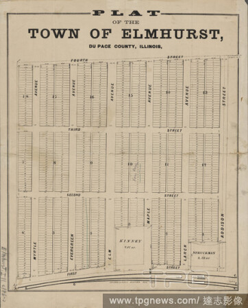
Editorial Plat of the town of Elmhurst, Du Page County, Illinois, cartographic, Maps, 1860 - 1869.
- 2021-04-07
- 1
Editorial Watson's New Map of New York, Brooklyn, Jersey City, &c., cartographic, Maps, 1872.
- 2021-04-07
- 2
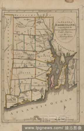
Editorial The state of Rhode-Island , cartographic, Maps, 1814, Harris, Caleb.
- 2021-04-07
- 1
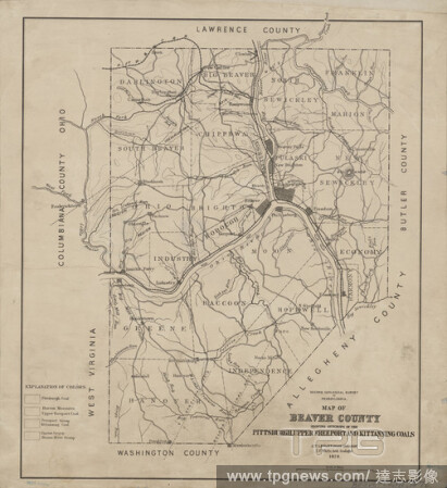
Editorial Map of Beaver County showing outcrops of the Pittsburgh, Upper Freeport and Kittanning coals , cartographic, Maps, 1877, Lesley, J. P. (J. Peter), 1819-1903, White, I. C. (Israel Charles), 1848-1927.
- 2021-04-07
- 2
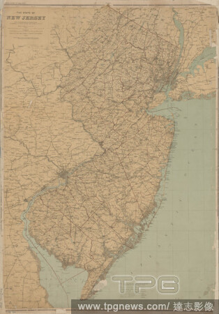
Editorial The State of New Jersey, cartographic, Maps, 1888, Cook, George Hammell, 1818-1889, Vermeule, C. C. (Cornelius Clarkson), 1858-1950, Julius Bien & Co.
- 2021-04-07
- 2
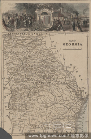
Editorial Map of Georgia, cartographic, Maps, 1860 - 1869.
- 2021-04-07
- 1
Editorial Broadway - Charleton purchase, cartographic, Maps, 1771.
- 2021-04-07
- 2
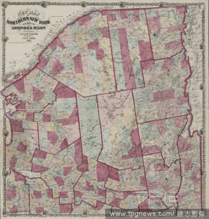
Editorial New map of northern New York including the Adirondack Region, cartographic, Maps, 1865.
- 2021-04-07
- 1
Editorial Topographical map in ten-foot contour curves of the Panther Creek Coal Basin in Carbon and Schuylkill Counties , cartographic, Maps, 1882, Rothwell, Richard P. (Richard Pennefather), 1836-1901, Hill, Frank A., Harden, Oliver B., Moyer, H. I., Lesley, J...
- 2021-04-07
- 1
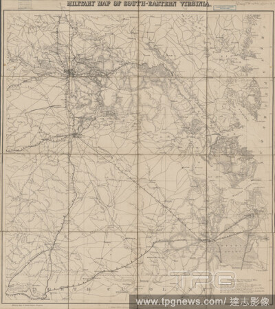
Editorial Military map of south-eastern Virginia , cartographic, Maps, 1861, Lindenkohl, H. (Henry), Krebs, Charles G.
- 2021-04-07
- 3
Editorial Manuscript map of an approximately 2-mile segment of Chickamaga (that is, West Chickamauga) Creek, south of Chattanooga, Tenn., south of the Chickamauga Battlefield, and west of Ringgold, Ga., cartographic, Maps, 1863.
- 2021-04-07
- 1

Editorial Map showing the boulevards and park system and twelve miles of lake frontage of the city of Chicago , cartographic, Maps, 1881, Rand McNally and Company.
- 2021-04-07
- 1
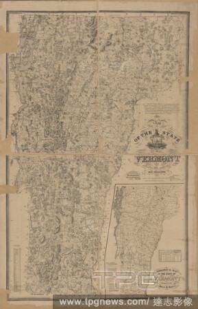
Editorial Map of the state of Vermont , cartographic, Maps, 1875, Walling, Henry Francis, 1825-1888.
- 2021-04-07
- 1

Editorial Map of New England with adjacent portions of New York & Canada, cartographic, Maps, 1881.
- 2021-04-07
- 1

Editorial Near the stone arch in Broadway, cartographic, Maps, 1774.
- 2021-04-07
- 1
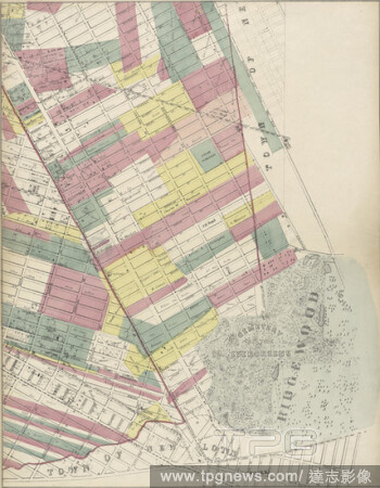
Editorial Sheet 4: Map encompassing Ocean Hill, Broasway Junction, Bushwick and Ridgewood, cartographic, Maps, 1869.
- 2021-04-07
- 2
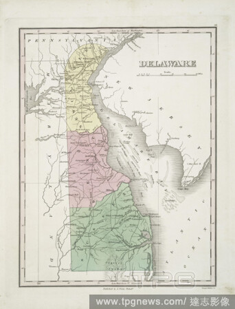
Editorial Delaware, cartographic, Maps, 1824, Young & Delleker, Finley, A. (Anthony).
- 2021-04-07
- 1
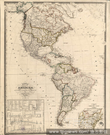
Editorial Karte von Amerika, cartographic, Maps, 1843, Mahlmann, Heinrich, 1812-1848.
- 2021-04-07
- 1
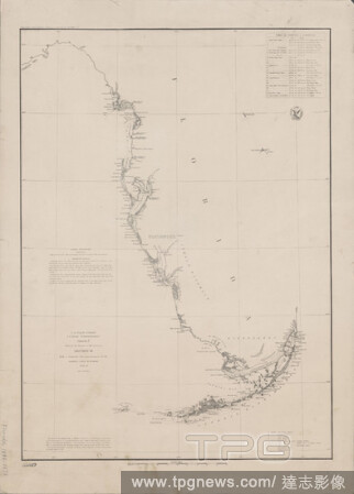
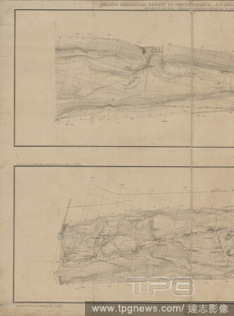
Editorial Sketch F, showing the progress of the survey in Section VI, with a general reconnoissance of the western coast of Florida, 1848-51 , cartographic, Maps, 1851, Bache, A. D. (Alexander Dallas), 1806-1867.
- 2021-04-07
- 3

Editorial Driving and cycling chart of south eastern Massachusetts, 1885, cartographic, Maps, 1885.
- 2021-04-07
- 2
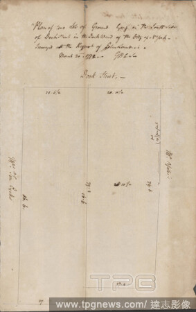
Editorial John Lambert's two lots in the Dock Ward, cartographic, Maps, 1772.
- 2021-04-07
- 2
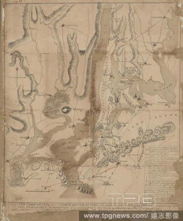
Editorial A plan of New York Island, part of Long Island, Staten Island & east New Jersey, with a particular description of the engagement on the woody heights of Long Island, between Flatbush and Brooklyn on the 27th of August 1776, cartographic, Maps, 1776, Fa...
- 2021-04-07
- 3
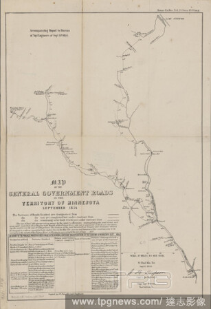
Editorial Map of the general government roads in the territory of Minnesota, September 1854 , cartographic, Maps, 1854, United States. Army. Corps of Topographical Engineers, Simpson, J. H. (James Hervey), 1813-1883, Sewall, J. S. (Joseph S.), 1827-1917, Wagner ...
- 2021-04-07
- 1
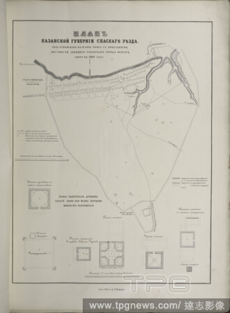
Editorial Plan Kazanskoi gubernii Spaskago uiezda sela Uspenskago Bolgary tozh, s pokazaniem mestnosti drevniago tatarskago goroda Bolgar. Sniato v 1869 godu, cartographic, Prints, 1871, Arkheologichesk siezd.
- 2021-04-07
- 1

Editorial Colton's Map of New York City, Brooklyn, Jersey City, Hoboken, &c., cartographic, Maps, 1873.
- 2021-04-07
- 1
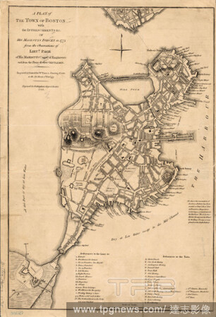
Editorial A plan of the town of Boston, cartographic, Maps, 1849, Page, Thomas Hyde, Sir, 1746-1821.
- 2021-04-07
- 1
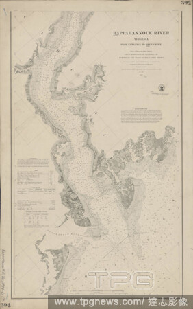
Editorial Rappahannock River, Virginia , cartographic, Maps, 1861, Bache, A. D. (Alexander Dallas), 1806-1867, Blunt, Edmund M. (Edmund March), 1770-1862, Palmer, W. R. (William R.), -1862, Seib, J. (John), Farley, John, 1802 or 1803-1874, Adams, I. Hull, Lee, S...
- 2021-04-07
- 3

Editorial City of New York., cartographic, Maps, 1854.
- 2021-04-07
- 1

Editorial Putnam County Florida, cartographic, Maps, 1883.
- 2021-04-07
- 1

Editorial A map of the British-plantations on the continent of America, cartographic, Maps, 1737, Moll, Herman (d. 1732 ), Salmon, Thomas (1679-1767 ), Stephens.
- 2021-04-07
- 1

Editorial Map of Jackson Park , cartographic, Maps, 1893, Heinze, Hermann.
- 2021-04-07
- 1

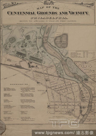
Editorial Map of Boston and vicinity, cartographic, Maps, 1898, Boston Elevated Railway Company.
- 2021-04-07
- 4
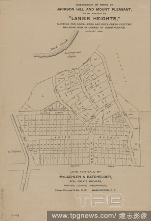
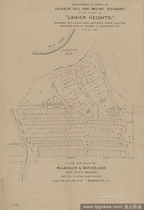
Editorial Sub-division of parts of Jackson Hill and Mount Pleasant, to be known as 'Lanier Heights', cartographic, Maps, 1890.
- 2021-04-07
- 3
Editorial A map of the British and French dominions in North America : with the roads, distances, limits, and extent of the settlements, humbly inscribed to the Right Honourable the Earl of Halifax, and the other Right Honourable the Lords Commissioners for Trad...
- 2021-04-07
- 1
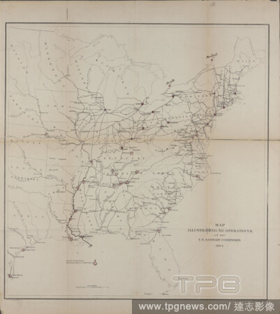
Editorial Map illustrating the operations of the U.S. Sanitary Commission, cartographic, Maps, 1864, United States Sanitary Commission, Krebs, Charles G., Lindenkohl, H. (Henry).
- 2021-04-07
- 1

Editorial Sheridan Village; Sheridan Business Directory; Sheridan Township, cartographic, Atlases, 1867.
- 2021-04-07
- 3

Editorial Map of New-York City, cartographic, Maps, 1884.
- 2021-04-07
- 1
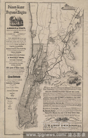
Editorial Map showing location of lands of the Pelham Manor & Huguenot Heights Association and their railroad communications with New York City., cartographic, Maps, 1874.
- 2021-04-07
- 4
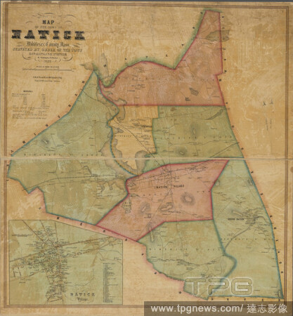
Editorial Map of the town of Natick, Middlesex County, Mass., cartographic, Maps, 1853, Walling, Henry Francis, 1825-1888, Friend & Aub.
- 2021-04-07
- 1

Editorial Map, cartographic, Documents, 1885.
- 2021-04-07
- 2

Editorial 1793 August 14, cartographic, Maps, 1793.
- 2021-04-07
- 2

Editorial Proposed parks and parkways, cartographic, Maps, 1876, Boston (Mass.). Park Dept.
- 2021-04-07
- 1

Editorial Plat of the private claims at Prairie du Chien , cartographic, Maps, 1828, Lyon, Lucius, 1800-1851, Graham, C. B. (Curtis B.).
- 2021-04-07
- 2
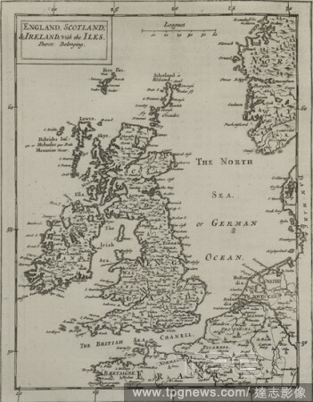
Editorial England, Scotland & Ireland, with the iles thereto belonging., cartographic, Maps, 1681, Flamsteed, John (1646-1719 ), Hanway, William, Moore, Jonas, Sir (1617-1679 ), Potenger, John, Perkins, Peter (d. 1680 ).
- 2021-04-07
- 2

Editorial New Hampshire & Vermont, cartographic, Maps, 1846, Mitchell, S. Augustus (Samuel Augustus), 1792-1868.
- 2021-04-07
- 1

Editorial Map of Louisiana , cartographic, Maps, 1853, McCulloh, William J.
- 2021-04-07
- 1

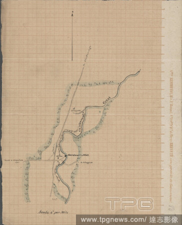
Editorial Map of a section of the Cobbessecontee River, cartographic, Maps, 1840.
- 2021-04-07
- 1
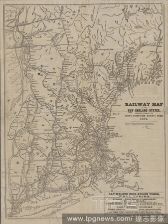
Editorial Railway map of the New England states, cartographic, Maps, 1867.
- 2021-04-07
- 2
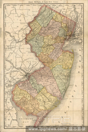
Editorial Rand, McNally & Co.'s New Jersey, cartographic, Maps, 1890.
- 2021-04-07
- 1

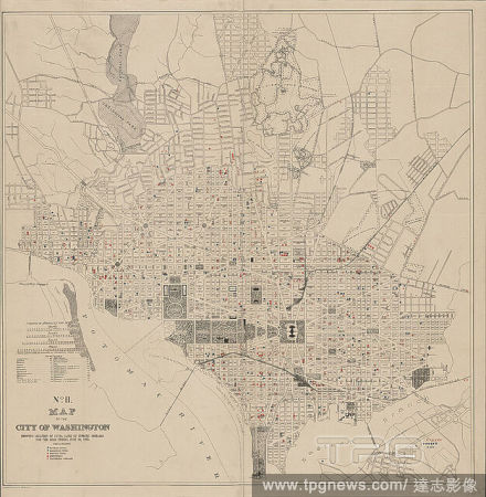
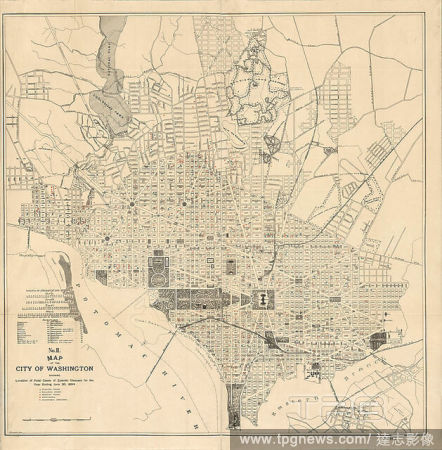
Editorial Topographical map of the District of Columbia and a portion of Virginia, cartographic, Maps, 1889, United States. Army. Corps of Engineers, Raymond, Chas. W. (Charles Walker), 1842-1913, Symons, T. W. (Thomas William), 1849-1920, Julius Bien & Co.
- 2021-04-07
- 2

Editorial New map of the city of Buffalo, cartographic, Maps, 1884, Matthews-Northrup Company.
- 2021-04-07
- 1
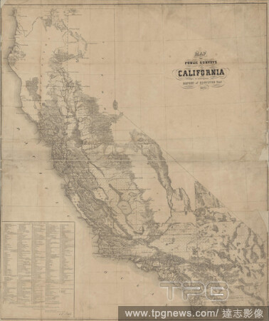
Editorial Map of public surveys in California , cartographic, Maps, 1861, United States. Surveyor General, Beale, Edward Fitzgerald, 1822-1893, Bien, Julius, 1826-1909.
- 2021-04-07
- 1
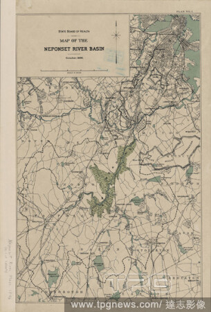
Editorial Map of the Neponset River basin, cartographic, Maps, 1896.
- 2021-04-07
- 1
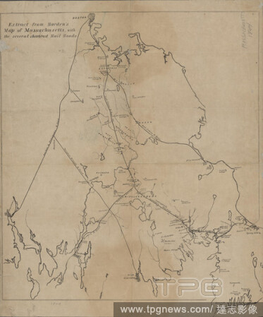
Editorial Extract from Borden's map of Massachusetts, cartographic, Maps, 1845, Borden, Simeon, 1798-1856.
- 2021-04-07
- 1
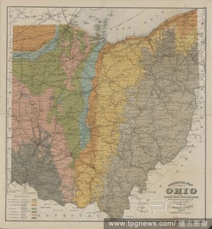
Editorial Geological map of Ohio , cartographic, Maps, 1888, Orton, Edward, 1829-1899, Newberry, J. S. (John Strong), 1822-1892, Strobridge Lithographing Company.
- 2021-04-07
- 3

Editorial Map of the city of Chicago, cartographic, Maps, 1853.
- 2021-04-07
- 1

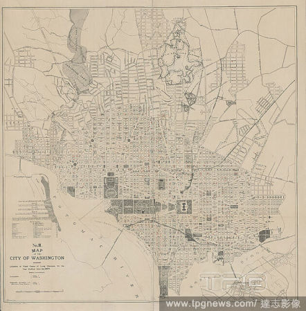
Editorial Topographical map of the District of Columbia and a portion of Virginia, cartographic, Maps, 1889, United States. Army. Corps of Engineers, Raymond, Chas. W. (Charles Walker), 1842-1913, Symons, T. W. (Thomas William), 1849-1920, Julius Bien & Co.
- 2021-04-07
- 1

Editorial Blanchard's map of Cook and DuPage Counties, 1871 , cartographic, Maps, 1871, Blanchard, Rufus, 1821-1904.
- 2021-04-07
- 1

Editorial Map of the city of New York., cartographic, Maps, 1869.
- 2021-04-07
- 1

Editorial Official map of the territory of Dakota, cartographic, Maps, 1887, Rand McNally and Company.
- 2021-04-07
- 1
Editorial A map of South Carolina and a part of Georgia, containing the whole sea-coast : all the islands, inlets, rivers, creeks, parishes, townships, boroughs, roads, and bridges , cartographic, Maps, 1780-06-01, Sackville, George Germain, Viscount, 1716-1785,...
- 2021-04-07
- 2

Editorial Topographical map of the District of Columbia and a portion of Virginia, cartographic, Maps, 1889, United States. Army. Corps of Engineers, Raymond, Chas. W. (Charles Walker), 1842-1913, Symons, T. W. (Thomas William), 1849-1920, Julius Bien & Co.
- 2021-04-07
- 1

Editorial Campaign map of the Department of the Platte , cartographic, Maps, 1873, Jones, William A. (William Albert), 1841-1914.
- 2021-04-07
- 2

Editorial Geological map of a part of southeastern New York showing the distribution of the rocks used as building stones, cartographic, Maps, 1895 - 1895, Merrill, Frederick J. H. (Frederick James Hamilton), 1861-1916.
- 2021-04-07
- 2
 Loading