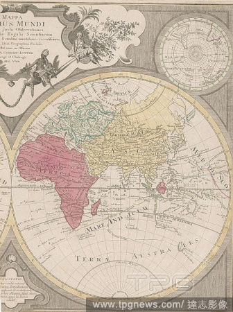
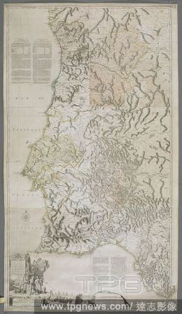
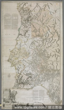
EditorialA map or chart of the Algarve and the Kingdom of Portugal. MAPPA ou CARTA GEOGRAPHICA DOS REINOS DE PORTUGALE ALGARVE. London : [Thomas Jefferys], 1762. Source: Maps K.Top.74.60.2.TAB. Language: Portuguese.
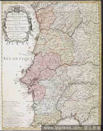
EditorialA map of the Kingdom of Portugal. Regnum Portugalliae ... una cum Regno Algarbiae speciali mappa exhibitum per J.B. Homannum. Norimbergae, 1736. Source: Maps K.Top.74.57.
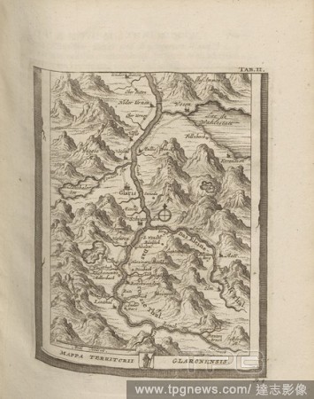
EditorialMappa Territory Glagonensis, Map of the Canton of Glarus, Tab. 2, to p. 178, 1723, Johann Jakob Scheuchzer: Ouresiphoites Helveticus, sive, itinera per Helvetiae alpinas regiones facta annis MDCCII, MDCIII, MDCCIV, MDCCV, MDCCVI, MDCCVII, MDCCIX, MDCCX...
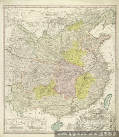
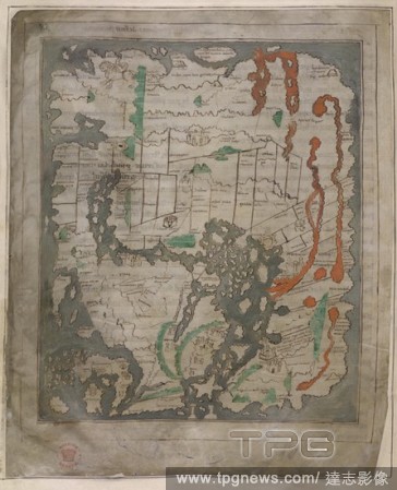
EditorialMap of China, Regni Sinae vel Sinae propriae Mappa et descriptio geographica (title on object), parts differently colored. Bottom right the title surrounded by dragons and plant motifs and some Chinese figures. Below left explanation of the layout of t...
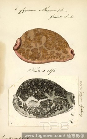
EditorialCypraea mappa, Print, Leporicypraea mappa (previously known as Cypraea mappa), common name the map cowry, is a species of large sea snail, a cowry, a marine gastropod mollusk in the family Cypraeidae, the cowries.
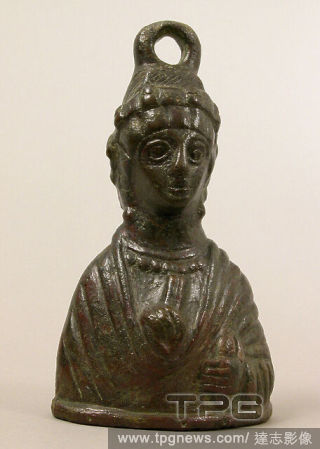
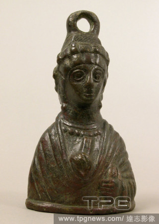
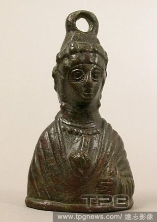
EditorialWeight in the Shape of a Byzantine Empress, 5th century, Byzantine, Copper alloy, 7 5/16 ? 4 ? 2 5/16 in., 2.7 lb. (18.5 ? 10.2 ? 5.9 cm, 1206g), Metalwork-Copper alloy, Portraits busts of Byzantine empresses were used for weights, thereby encouraging ...
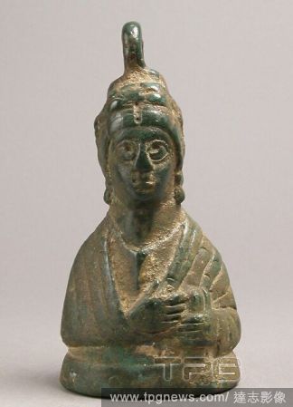
EditorialWeight in the Shape of a Byzantine Empress, 5th century, Byzantine, Copper alloy, filled with metal, 5 1/2 ? 2 11/16 ? 1 3/4 in., 3.5 lb. (13.9 ? 6.9 ? 4.5 cm, 1574g), Metalwork-Copper alloy, Portraits busts of Byzantine empresses were used for weights...
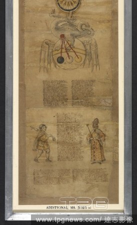
EditorialA white dragon biting on the moon, and standing on a winged mappa mundi -style orb; from its belly, three red strands are descending, one each to a black, white and gold orb below. - verses; to the left, a man in peasant dress holding a staff that ends...
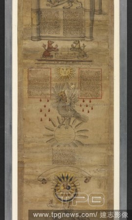
EditorialA yellow sun, between two panels bearing verses; beneath, a crowned male Bird of Hermes biting on its left wing, with drops of blood falling on either side, and standing on a sea-filled orb stuck with feathers; beneath, verses and a blank scroll. A go...
EditorialA map or chart of the Algarve and the Kingdom of Portugal. MAPPA ou CARTA GEOGRAPHICA DOS REINOS DE PORTUGALE ALGARVE. London : [Thomas Jefferys], 1762. Source: Maps K.Top.74.60.2.TAB. Language: Portuguese.
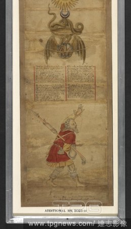
EditorialA crescent moon, being bitten by a large brown dragon, beneath, standing on a winged mappa mundi -style orb upon which droplets of blood are falling from the dragon's belly. - verses, in four stanzas. - a waving male figure in peasant dress, holding a ...
EditorialThe Tiberius Map. Mappa Mundi; only surviving world map from Anglo-Saxon England. It is divided into the three continents of Europe, Asia and Africa, with the Mediterranean Sea in the centre.The outline and detail of the British Isles are relatively ac...
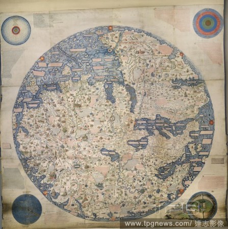
EditorialLarge Planisphere, or Mappa Mondo. Mappa Mondo. 1804. Original, 1459. Large Planisphere, or Mappa Mondo, compiled and drawn in the year 1459 by Fra. Mauro, a monk of the Order of Camaldoli. A coloured copy on vellum, about seven feet square, executed b...
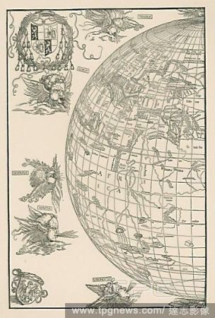
EditorialWorld Map of Johannes Stabius (Mappa mundi). Dated 1515. Woodblock (printed from four blocks), 645 x 850mm. For the right part see 33-02-03/18.
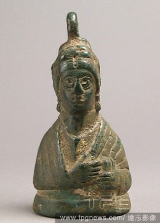
EditorialWeight in the Shape of a Byzantine Empress, 5th century, Byzantine, Copper alloy, 7 5/16 ? 4 ? 2 5/16 in., 2.7 lb. (18.5 ? 10.2 ? 5.9 cm, 1206g), Metalwork-Copper alloy, Portraits busts of Byzantine empresses were used for weights, thereby encouraging ...
EditorialWeight in the Shape of a Byzantine Empress, 5th century, Byzantine, Copper alloy, filled with metal, 5 1/2 ? 2 11/16 ? 1 3/4 in., 3.5 lb. (13.9 ? 6.9 ? 4.5 cm, 1574g), Metalwork-Copper alloy, Portraits busts of Byzantine empresses were used for weights...


 Loading