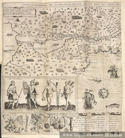
EditorialA map of 'New France', made in 1612. With the arms of Henry iv., King of France, four figures of Indians, representations of seals, fishes, and ships, and a border of Canadian fruit and flowers. Carte Geographique de la Nouvelle Franse faiette par le S...
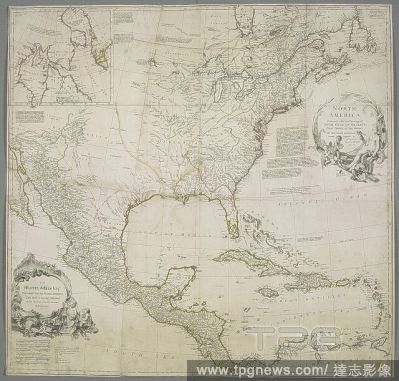
EditorialA map of North America. A map of Hudson Bay and Baffin's Bay inset at upper left. NORTH AMERICA. : Performed under the Patronage of LOUIS DUKE OF ORLEANS, FIRST PRINCE OF THE BLOOD. [London] : BY THE SIEUR D'ANVILLE. Greatly Improved by M.r BOLTON. Ing...
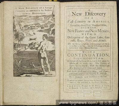
EditorialTitle page of seventeenth-century account of discovery in America. Illustration showing a native man with bow and arrow, and canoe on the water. . Nouvelle decouverte d’un tres grand pays situe? dans l’Ame?rique A New Discovery of a Vast Country ...
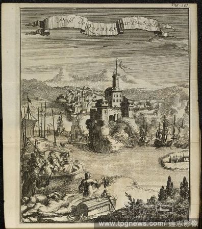
EditorialAn illustration of seventeenth-century Quebec. Nouveau voyage d’un pais plus grand que l’Europe, avec les reflections des entreprises du Sieur de la Salle, sur les mines de St. Barbe, etc. Enrichi de la Carte, de figures, etc. Utrecht, Netherlands,...


 Loading