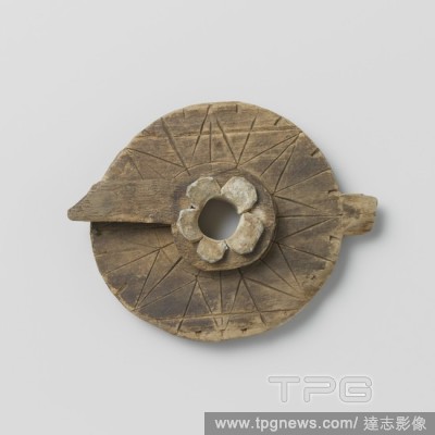
EditorialMeasuring instrument, possibly for measuring courses, consisting of a round wooden disc with a rotating pointer on a lead axis, Measuring instrument (course meter) consisting of a round wooden disc with a rotating pointer on a lead ash. On the top and ...
EditorialMapping company at an outside table, playing cards, Europe, anonymous, Groningen, c. 1850 - c. 1880, cardboard, photographic paper, albumen print, h 85 mm ? w 170 mm.
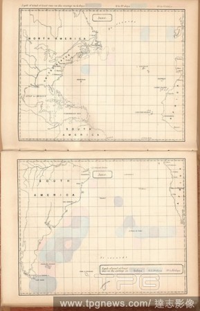
EditorialA gale of wind at least once on the average in 6 days, 6 to 10 days, 10 to 14 days, Mapping of storms on the oceans, Fig. 2, 1858, M. F. Maury: Sailing directions. Washington, [s.n.], 1858-1859.
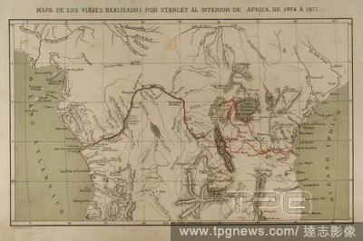
EditorialExploration and mapping of the Congo River (1874-1877). Henry Morton Stanley. He traveled central Africa exploring Lake Victoria and Lake Tanganyka navigating the Congo River. Africa inexplorada, el Continente Misterioso by Henry Morton Stanley, c. 1887.
EditorialMapping the land charts, Fig. 1: Networks for a charter from Europe, Fig. 2: Example of a special card, Fig. 3: Characters for special cards, Tab. XXXI, p. 38, Tobias Mayer: Mathematischer Atlas, in welchem auf 60 Tabellen alle Theile der Mathematic vo...
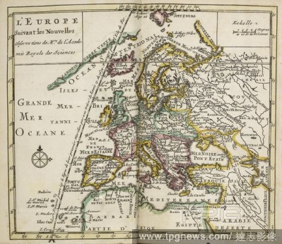
EditorialMap of L'Europe, Suviant Les Novelles Observations, new observations and information about mapping. . Atlas Portatif et Nouveau du Voyageur. Amsterdam. Published between 1695-1700. Atlas Portatif et Nouveau du Voyageur. Tome 1. Qui contient, le Monde, ...
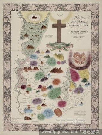
EditorialThe Map of Human Life with passages in Sacred Writ. An allegorical mapping of life and the events thereof. . An Illustrative Map of Human Life, deduced from passages in Sacred Writ. New York, America. An Illustrative Map of Human Life, deduced from pas...
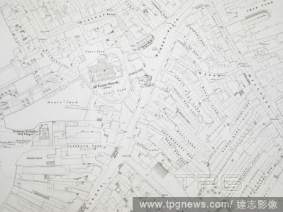
EditorialThe engraving of 1:1056 scale mapping was authorised in December 1846, and Wigan was the first town to be completed in 1848 . Ordnance Survey of Wigan 5 feet to a mile. Southampton, 1848. Source: Maps O.S.T.(100.), sheet 5. Language: English.


 Loading