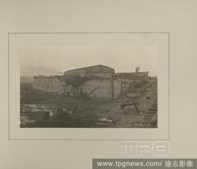
EditorialSalford - Dock Wall and Gate Shed, G. Herbert & Horace C. Bayley, Manchester, England, negative February 1892, print 1894, Gelatin silver print, 13.9 ? 23.2 cm (5 1/2 ? 9 1/8 in.).
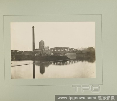
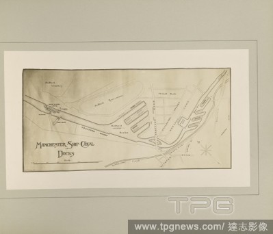
EditorialPlan of Manchester and Salford Docks, G. Herbert & Horace C. Bayley, Manchester, England, 1894, Gelatin silver print, 12.6 ? 25.4 cm (4 15/16 ? 10 in.).
EditorialShakespeare?s Seven Ages (of Man) (Furnishing Fabric), c. 1805, Engraved by John Slack (English, active 1794-1828) and others after paintings by Robert Smirke?s (English, 1752?1845), England, Lancashire, Salford, England, Cotton, plain weave, copperpla...
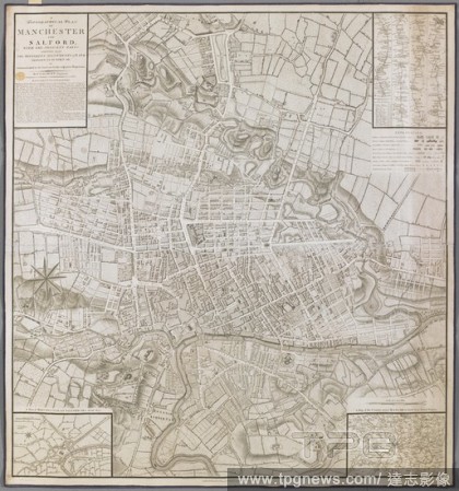
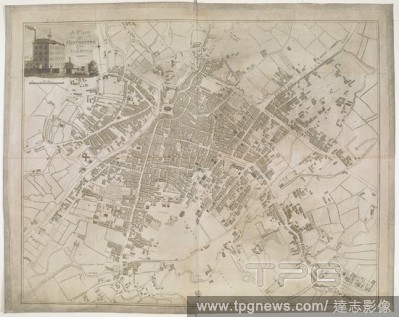
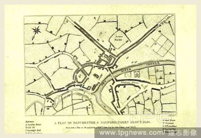
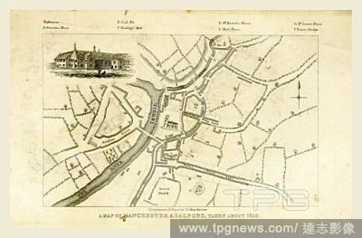
EditorialA plan of Manchester and Salford. A Topographical Plan of Manchester and Salford, with the adjacent parts, shewing also the different allotments of Land proposed to be built on ... [With] A Plan of Manchester and Salford taken about 1650 [and] A Map of...
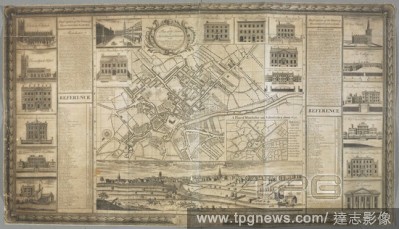
EditorialA plan of Manchester and Salford. A Plan of the Towns of MANCHESTER & SALFORD in the County Palatine of Lancaster. [Manchester] : [John Berry], [1751.]. Source: Maps K.Top.18.78.2.TAB. Language: English.
EditorialA plan of part of Manchester. Ordnance Plan of Manchester and Salford. Scale, 1 : 500 or 10.56 feet to one mile. 1891. Source: Maps OST.215, sheet CIV.6.19. Language: English.
EditorialA plan of Manchester & Salford. Manchester & Salford. Scale, 1/4 of a mile[ = 25 mm.] ... Engraved by J. Roper, from a survey by Thornton ... 1807. London : Vernor, Hood, and Sharpe, 1810. Source: Maps 11.b.3, page 74. Language: English.
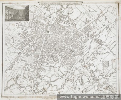
EditorialA plan of Manchester and Salford. A Plan of Manchester and Salford, drawn from an actual survey, by William Green, begun in the year 1787 and compleated in 1794. Manchester : W. Green, 1794. Source: Maps K.Top.18.80.5.Tab.end. Language: English.
EditorialA plan of Manchester and Salford. A Plan of Manchester and Salford. Manchester : Bancks and Thornton, [1800?]. Source: Maps * 3215.(1.). Language: English.


 Loading