
filter
-
Brand
- By Category
- Direction
- Date Range
243Events
Pictures
Events

Editorial Sabrina Carpenter surprises fans with free Blank Street Espresso
- 2024-06-18
- 5

Editorial EXCLUSIVE: Home belonging to famous songwriter who composed hits for Celine Dion and Meatloaf on sale ? including PIANO he wrote anthems on
- 2024-01-08
- 2

Editorial New Barbie and Ken dolls from $1 billion blockbuster movie - including neon rollerblading outfits
- 2023-08-09
- 9

Editorial Taylor Swift makes global music history once again in 2022
- 2022-12-22
- 1

Editorial New Balance hoops unveils collaboration with CEO and agent Rich Paul. Paul is also in a relationship with superstar singer Adele
- 2021-12-10
- 3
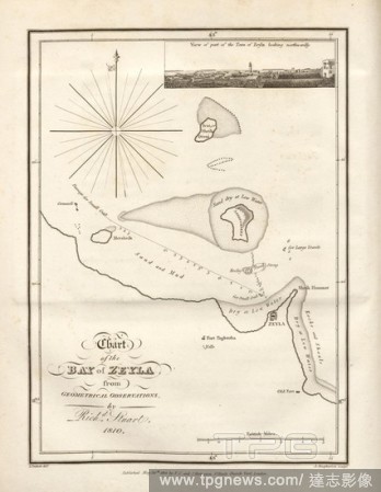
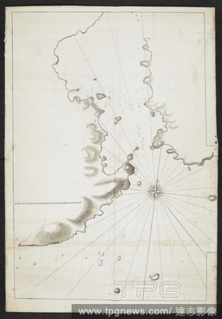
Editorial Chart of the Bay of Zeyla from Geometrical Observations, Sketch of Zeyla Bay with an additional view of the village of Zeyla, after p. 474, p. 553, Outhett, John (del.); Macpherson, Alexander (sculp.), 1810, Henry Salt: A voyage to Abyssinia, and trave...
- 2020-01-15
- 1

Editorial wind directions, Round Chart with directions and directions, woodcut, p. 39, (Liber tertius), Manuel, Hans Rudolf (graveur sur bois), 1556, Georgius Agricola: De re metallica libri XII: quibus officia, instrumenta, machinae, ac omnia denique ad metalli...
- 2020-01-15
- 1
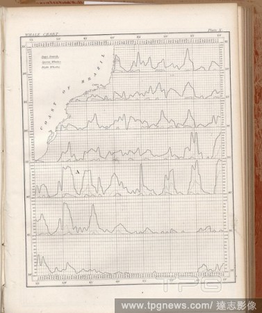
Editorial Whale Chart 1, Occurrence of sperm whales and right whales off the coast of Brazil, Pl. X, 1858, M. F. Maury: Sailing directions. Washington, [s.n.], 1858-1859.
- 2020-01-15
- 1
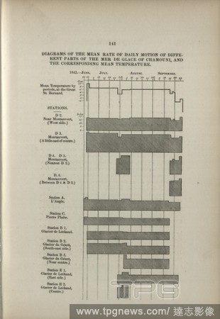
Editorial Diagrams of the mean rate of daily motion of different parts of the mer de glace of Chamouni, and the corresponding mean temperature, Glacier Observation Chart, p. 141, Forbes, James David, 1843, James David Forbes: Travels through the alps of Savoy an...
- 2020-01-15
- 1
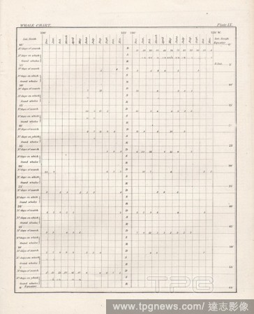
Editorial Whale Chart 1, Table for the occurrence of whales in different marine areas by months, Pl. IX, 1858, M. F. Maury: Sailing directions. Washington, [s.n.], 1858-1859.
- 2020-01-15
- 1
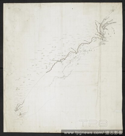
Editorial General Chart of the East Coast of Africa, Detailed map of the east coast of Africa, supplemented by profiles and a detailed view of the coast from Mo?ambique to Cape Delgado, according to p. 12, p. 31, Outhett, John (drawn); Macpherson, Alexander (eng...
- 2020-01-15
- 1

Editorial Charter to navigate, Nautical chart, Fig. 46, p. 198, Porro, Girolamo (ill.), 1575, Thomaso Porcacchi, Girolamo Porro: L' isole piu famose del mondo. Il secondo libro. In Venetia: apresso gli Heredi di Simon Galignani, 1590.
- 2020-01-15
- 1
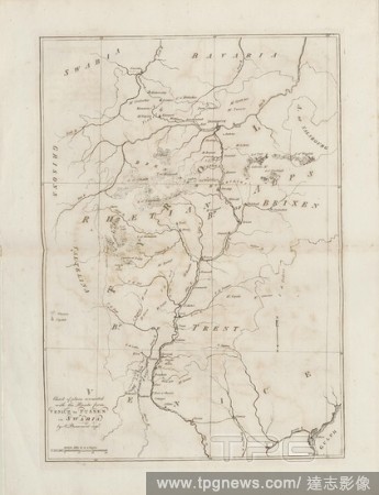
Editorial Chart of places connected with the Route from Venice to Fussen in Swabia, Map of the route from Venice to F?ssen in Germany, Signed: by A. Beaumont, Fig. 1, according to S. viii, Albanis Beaumont, Jean-Fran?ois (inv.), 1792, Jean-Fran?ois Albanis Beaum...
- 2020-01-15
- 1

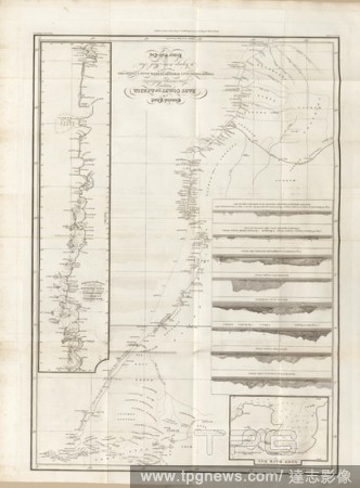
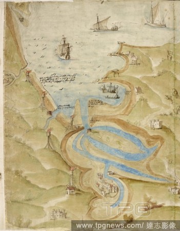
Editorial Chart of the Bay of Arkeeko and Harbour of Masuah, Map and illustration of the Bay of Arkeeko, based on the observations of Captain T. Weaterhead, after p. 208, p. 246, Outhett, John (del.); Macpherson, Alexander (sculp.), 1810, Henry Salt: A voyage to...
- 2020-01-15
- 1
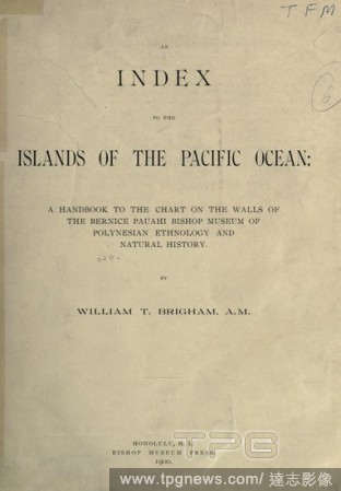
Editorial An index to the islands of the Pacific Ocean: a handbook to the chart on the walls of the Bernice Pauahi Bishop museum of Polynesian ethnology and natural history : Brigham, William T. (William Tufts), 1841-1926.
- 2019-12-18
- 1

Editorial Navigation Map adjuster of brass with a long and short leg, Map adjuster with two legs, each at the top semi-circular and split and hinged in such a way that the upper part of the legs forms a ring in the closed upper edge. The short leg is pierced and...
- 2019-12-18
- 1

Editorial Nebuleuse de la Lyre.
- 2019-11-18
- 1

Editorial Glass Positive - 'Distribution of Radial Velocities in Sunspots', circa 1920s, Glass slide of a chart showing distribution of radial velocities in sunspots, from a book by American astronomer Charles Edward St John, circa 1920s. It is part of a collect...
- 2019-11-18
- 1

Editorial Lantern Slide - Chart - Coloured Routes Drawn by Eric Douglas, Ellsworth Relief Expedition, Antarctica, 1935-1936, Lantern slide of a chart of Antarctica. One of 328 images in various formats including artworks, photographs, glass negatives and lantern...
- 2019-11-18
- 1

Editorial A Section of the Constellation Cygnus (August 13, 1885).
- 2019-11-18
- 1

Editorial Chart of the Signs of the Zodiac with Venus, Cupid, and a Bishop Saint.
- 2019-10-28
- 1
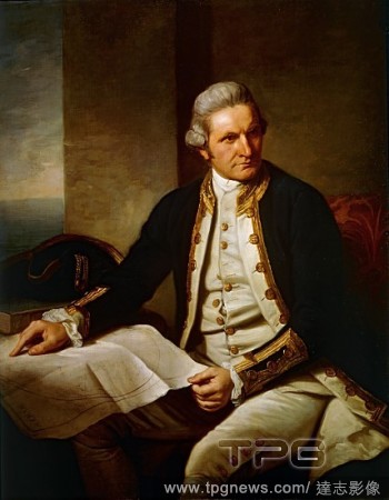
Editorial Captain James Cook (1728-1779) Canvas; 1270 x 1016 mm Painted 1775-76 BHC2628 A three-quarter-length portrait of Captain Cook, seated to the left, facing the right. He is wearing captain's full-dress uniform, 1774-87, consisting of a navy bl...
- 2019-08-02
- 1

Editorial Calendar chart. North French Miscellany. France, 1278-1298. Source: Add. 11639, f.542v. Language: Hebrew.
- 2019-07-16
- 1
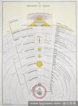
Editorial Ordinamento del Paradiso. An astronomical chart. La Materia Divina Commedia ... dichiarata in VI tavole da M. Caetani. Roma, 1855. Source: 1875.b.14 plate VI.
- 2019-07-16
- 1
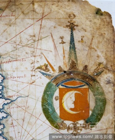
Editorial Francesc Oliva / Mediterranean nautical chart, 16th century. Inv. 10257.
- 2019-07-02
- 2

Editorial Membership meeting of an agricultural cooperative in Central Hungary, to discuss production goals for 1956. In the background, a production chart. Hungary,1956.
- 2019-05-16
- 1
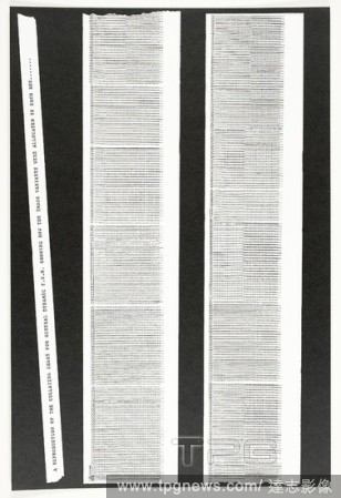
Editorial Collating Chart, from General Dynamic F.U.N. Eduardo Paolozzi (British, 1924-2005); printed by Richard Davis, London; published by Editions Alecto, London. Date: 1970. Dimensions: 380 ? 254 mm. Photolithograph on paper. Origin: England.
- 2019-03-18
- 1
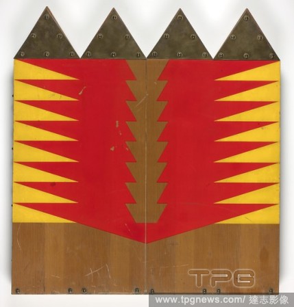
Editorial The Software Chart Questionnare. Joe Tilson (English, b. 1928); printed by Sergio Tosi (Italian, 20th century). Date: 1968. Dimensions: 561 ? 521 ? 41 mm (bo?). Box of finished plywood, veneers and solid wood, red and yellow paint, and brass plates and...
- 2019-03-18
- 2

Editorial Pocket Qur'an.
- 2019-02-22
- 1

Editorial Chart of the Signs of the Zodiac with Venus, Cupid, and a Bishop Saint.
- 2019-02-22
- 1

Editorial Vase (one of a pair).
- 2019-02-15
- 1

Editorial Vase (one of a pair).
- 2019-02-15
- 1

Editorial Sampler listing the counties of England.
- 2019-02-15
- 1

Editorial CUP.
- 2019-02-15
- 1

Editorial A Section of the Constellation Cygnus (August 13, 1885).
- 2019-02-11
- 1

Editorial Color Chart with Annotations [verso]. Dated: 1884-1888. Dimensions: overall: 16.9 x 13.2 cm (6 5/8 x 5 3/16 in.). Medium: pen and brown ink on wove paper.
- 2019-02-01
- 1
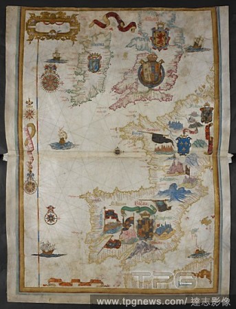
Editorial Chart of western Europe, including the British Isles, Ireland, France, Spain, Portugal, the western Mediterranean Sea, and part of North Africa. With armorial decoration. Queen Mary Atlas. 1558. Source: Add. 5415 A, ff.9v-10.
- 2019-01-24
- 1

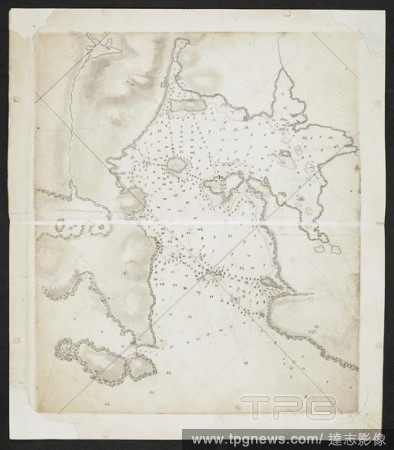
Editorial North Atlantic coast of America. Portolano. Italy [Naples?]; circa 1508. [Whole chart] An outline of the east coasts of North and South America. The volume appears to be a copy of one of the early portolani of Visconti Maggiola, of Genoa, and the earli...
- 2019-01-24
- 1

Editorial Calendar chart. North French Miscellany. France, 1278-1298. Source: Add. 11639, f.542v. Language: Hebrew.
- 2019-01-24
- 1
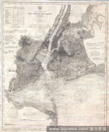
Editorial 1910, U.S. Coast Survey Nautical Chart or Map of New York City and Harbor.
- 2019-01-23
- 1
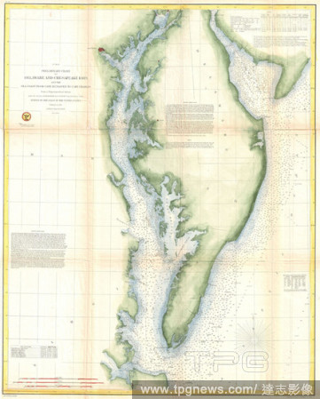
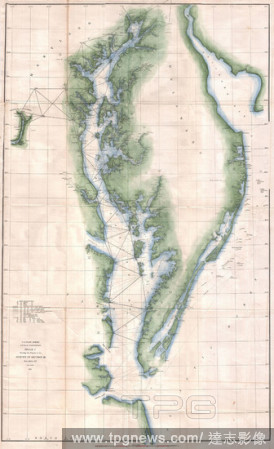
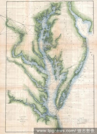
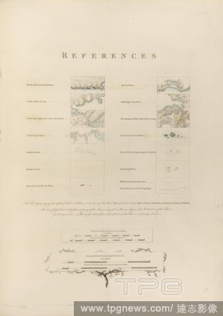
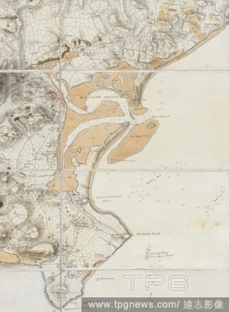
Editorial 1855, U.S. Coast Survey Chart or Map of Chesapeake Bay and Delaware Bay.
- 2019-01-23
- 1
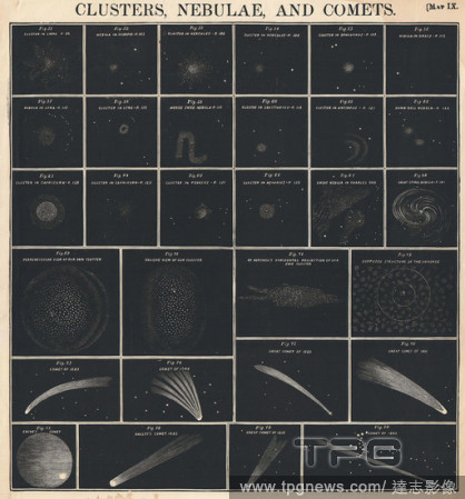
Editorial 1856, Burritt, Huntington Chart of Comets, Star Clusters, Galaxies, and Nebulae.
- 2019-01-23
- 1

Editorial 1868, British Admiralty Chart or Map of the Mediterranean Sea, Italy, Corsica, Greece, Tunisia.
- 2019-01-23
- 1

Editorial 1864, U.S. Coast Survey Map or Chart of St. Georges River and Muscle Ridge Channel, Maine.
- 2019-01-23
- 1
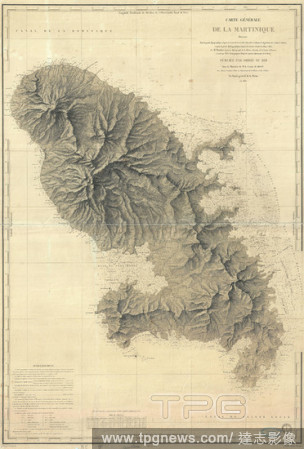
Editorial 1831, Depot de la Marine Nautical Chart or Map of Martinique, West Indies.
- 2019-01-23
- 1

Editorial 1893, U.S. Coast Survey Nautical Chart or Map of the Chesapeake Bay and Delaware Bay.
- 2019-01-23
- 1

Editorial 1859, U.S. Coast Survey Chart or Map of Hempstead Harbor, Long Island, New York.
- 2019-01-23
- 1

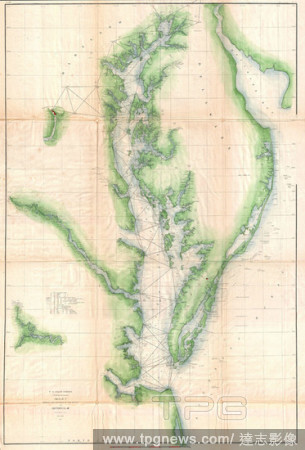
Editorial 1855, U.S. Coast Survey Nautical Chart or Map of the Chesapeake Bay.
- 2019-01-23
- 1

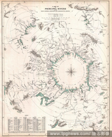
Editorial 1864, Johnson's World Mountains and Rivers Map or Chart.
- 2019-01-23
- 1
Editorial 1855, U.S. Coast Survey Chart or Map of Washington and Oregon.
- 2019-01-23
- 1
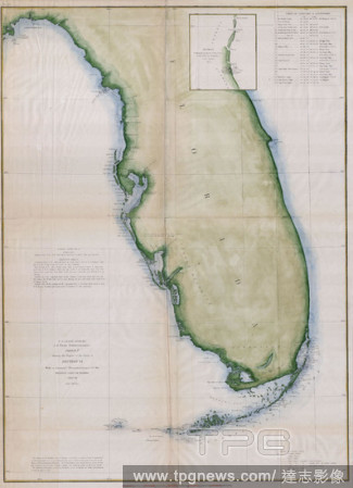
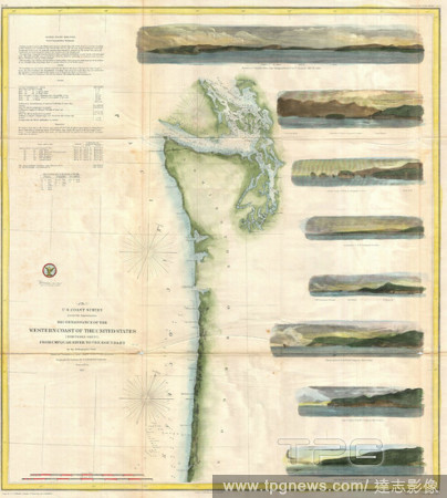
Editorial 1853, U.S.C.S. Map or Chart of Florida.
- 2019-01-23
- 1
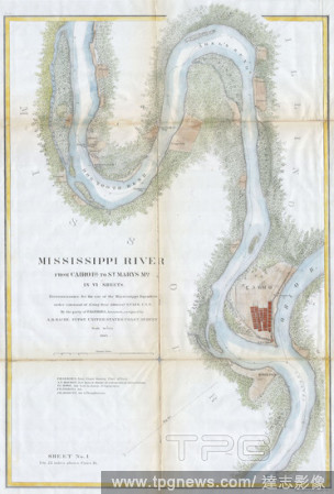
Editorial 1865, U.S.C.S. Chart or Map of the Mississippi River around Cairo Illinois.
- 2019-01-23
- 2

Editorial 1857, U.S. Coast Survey Map or Chart of the Rappahannock River, Virginia.
- 2019-01-23
- 1
Editorial 1834, S.D.U.K. Comparative Map or Chart of the World's Great Rivers.
- 2019-01-23
- 1

Editorial 1852, U.S. Coast Survey Chart or Map of the Chesapeake Bay and Delaware Bay.
- 2019-01-23
- 1
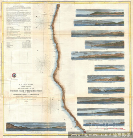
Editorial 1854, U.S. Coast Survey Chart or Map of California and Oregan north of San Francisco.
- 2019-01-23
- 1

Editorial 1857, U.S. Coast Survey Chart or Map of the Washington Coast, Puget Sound, Vancouver.
- 2019-01-23
- 1

Editorial 1873, U.S. Coast Survey Chart of Map of Cape Cod, Nantucket, Marthas Vineyard, and Cape Ann.
- 2019-01-23
- 1

Editorial 1858, U.S.C.S. Map or Chart of Martha's Vineyard or Muskeget Channel.
- 2019-01-23
- 1

Editorial 1857, U.S. Coast Survey Chart or Map of Chesapeake Bay and Delaware Bay.
- 2019-01-23
- 1

Editorial 1864, U.S.C.S. Chart of the Mississippi River Grand Gulf to New Carthage, Jefferson Davis Plantation.
- 2019-01-23
- 1

Editorial 1855, U.S.C.S. Map or Chart of Washington and Oregon.
- 2019-01-23
- 1
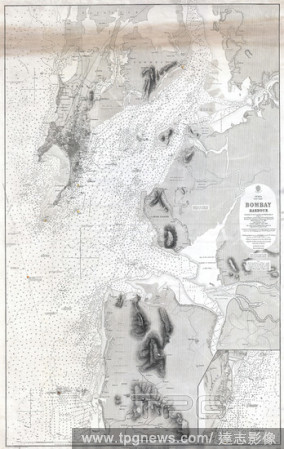
Editorial 1879, British Admiralty Chart or Map of Bombay Harbor, India, Mumbai.
- 2019-01-23
- 1

Editorial 1855, U.S. Coast Survey Chart or Map of Chesapeake Bay and Delaware Bay.
- 2019-01-23
- 1
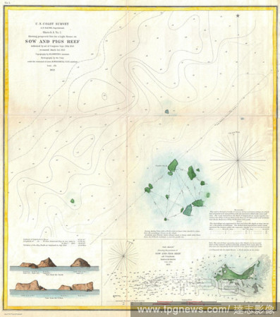
Editorial 1853, U.S. Coast Survey Map or Chart of Sow and Pigs Reef off Marthas Vineyard, Massachussetts.
- 2019-01-23
- 1

Editorial 1875, U.S. Coast Survey Chart or Map of the Carolina Coast.
- 2019-01-23
- 1
Editorial 1851, U.S. Coast Survey Chart or Map of the Chesapeake Bay and Delaware Bay.
- 2019-01-23
- 1
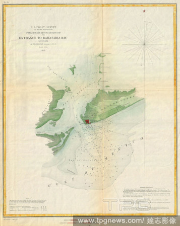
Editorial 1853, U.S. Coast Survey Map or Chart of Bartaria Bay, Louisiana.
- 2019-01-23
- 1

Editorial 1862, U.S. Coast Survey Map of the Kennebec and Sheepscot Rivers, Maine, Nautical Chart.
- 2019-01-23
- 1
Editorial 1855, U.S. Coast Survey Chart or Map of Chesapeake Bay and Delaware Bay.
- 2019-01-23
- 1

Editorial 1874, U.S.C.S. Map or Chart of Lake Champlain, Burlington, VT.
- 2019-01-23
- 1

Editorial 1855, U.S. Coast Survey Chart or Map of Tampa Bay, Florida.
- 2019-01-23
- 1
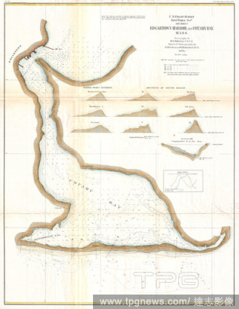
Editorial 1871, U.S. Coast Survey Map or Chart of Edgartown Harbor, Martha's Vineyard, Massachusetts.
- 2019-01-23
- 1

Editorial 1857, U.S. Coast Survey Map or Chart of the Rapphannock River South, Virginia.
- 2019-01-23
- 1

Editorial 1865, U.S. Coast Survey Map or Chart of Providence, Rhode Island.
- 2019-01-23
- 1

Editorial 1865, Bellin Sea Chart of Western Africa, Senegal, Gambia, Guinea, etc.
- 2019-01-23
- 1
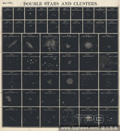
Editorial 1856, Burritt, Huntington Chart of Star Clusters and Double Stars.
- 2019-01-23
- 1

Editorial 1867, U.S. Coast Survey Chart or Map of Puget Sound, Washington.
- 2019-01-23
- 1

Editorial 1866, Johnson Chart of World Time Zones, from Washington.
- 2019-01-23
- 1

Editorial 1873, U.S. Coast Survey Chart or Map of New Jersey and the Delaware Bay.
- 2019-01-23
- 1
Editorial 1873, U.S. Coast Survey Chart or Map of the Chesapeake Bay and Delaware Bay.
- 2019-01-23
- 1

Editorial 1873, U.S. Coast Survey Chart or Map of the Carolina Coast.
- 2019-01-23
- 4
Editorial Topographical features. [A Chart of Nantucket Island... 1776. Various topographical features. Image taken from: [A Chart of Nantucket Island and part of Martha's Vineyard]. Published in 1776 . Source: Maps.184.m.3.(37). Language: English.
- 2019-01-23
- 1
Editorial Wexford Harbour. A colored chart of the harbours of Waterford and W. 1776. Wexford Harbour and Greenore Bay. Image taken from A colored chart of the harbours of Waterford and Wexford, with the coast adjacent; drawn in 1776, by Lieut.-Col. Charles Vall...
- 2019-01-23
- 1
Editorial Map of Mount's Bay in Cornwall. Coastline. Sand flats and sheltered estuary and bay. Ships. . A Large colored chart of Mount’s Bay, in Cornwall. Cornwall, drawn c. 1540. A Large colored chart of Mount’s Bay, in Cornwall, drawn c. 1540. . Source: Co...
- 2019-01-23
- 1
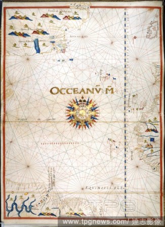
Editorial Chart of the Atlantic Ocean. Portolano. Spain; before 1600. [Whole chart] Chart of the Atlantic Ocean, with Ireland, Portugal, and part of the west coast of Africa, including the Azores, Madeira, Canary Islands, and Cape Verde Islands. The western Atla...
- 2018-12-06
- 1
Editorial Chart of coastlines and islands. SIXTY-SEVEN Charts and maps illustrating the voyages and surveys of Capt. James Cook, R.N., and other discoverers; circ. 1760- 1780. c 1760-1780. Source: Add. 31360, no.18.
- 2018-12-06
- 1

Editorial Chart of the Gulf of Mexico and the Pacific Ocean, from 34? north to 11? south. Jean Rotz, Boke of Idrography (The 'Rotz Atlas'). c 1535-1542. Source: Royal MS 20 E IX f.8. Language: French & English.
- 2018-12-06
- 1

Editorial Chart of the southern hemisphere. SIXTY-SEVEN Charts and maps illustrating the voyages and surveys of Capt. James Cook, R.N., and other discoverers; circ. 1760- 1780. c 1760-1780. Source: Add. 31360, no.6.
- 2018-12-06
- 1
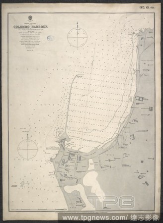
Editorial A chart of Colombo Harbour. Colombo Harbour. From surveys supplied by Sir J. Coode, 1878 and 1885 ... Natural scale, 1 : 6937. [Admiralty Chart]. London, 1885. Source: Maps SEC.12.(914.). Language: English.
- 2018-12-06
- 1
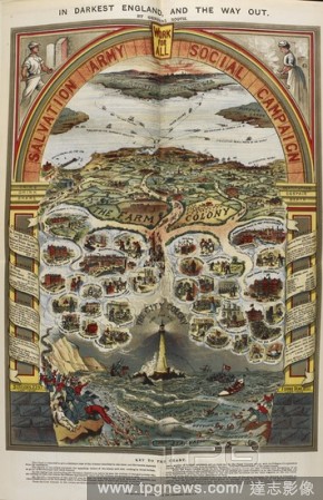
Editorial A 19th century colour chart depicting the 'misery and ruin existing in Great Britain'. . In darkest England and the way out / by General Booth. London : International Headquarters of the Salvation Army, [1890] William Burgess [printer]. Source: RB.23.a...
- 2018-12-06
- 1
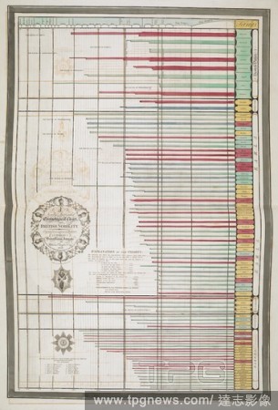
Editorial 'A newly invented chronological chart of British nobility ...'. British family antiquity : illustrative of the origin and progress of the rank, honours, and personal merit, of the nobility of the United Kingdom ; accompanied with an elegant set of chro...
- 2018-12-06
- 1
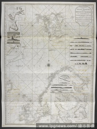
Editorial A new chart for the whale fishery and archangel-traders or the navigation in the Northern Seas, from Great Britain and Ireland to Spitsbergen and the White Sea. A Pilot for the Greenland Whale Fishery. Containing the North Sea, Shetland, Orkney, and Fa...
- 2018-12-06
- 1

Editorial A chart of China-East Coast. Hong Kong to the Gulf of Liau-Tung. China--East Coast. Hong Kong to Gulf of Liau-Tung, compiled ... 1876. [Admiralty Chart]. London, 1877. Source: Maps SEC.13.(1262.). Language: English.
- 2018-12-06
- 1

Editorial Chart of the coasts of Asia and Africa from Cape Comorin to Cape Delgado, including the Persian Gulf and the Red Sea. Jean Rotz, Boke of Idrography (The 'Rotz Atlas'). c 1535-1542. Source: Royal MS 20 E IX f.11v. Language: French & English.
- 2018-12-06
- 1

Editorial Chart of western Europe, including the British Isles, Ireland, France, Spain, Portugal, the western Mediterranean Sea, and part of North Africa. With armorial decoration. Queen Mary Atlas. 1558. Source: Add. 5415 A, ff.9v-10.
- 2018-12-06
- 1
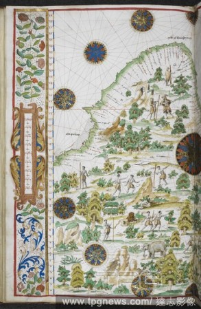
Editorial Chart of South Africa from 15? south on the east coast to 6? north on the west coast. Jean Rotz, Boke of Idrography (The 'Rotz Atlas'). c 1535-1542. Source: Royal MS 20 E IX f.15v. Language: French & English.
- 2018-12-06
- 1
Editorial A chart showing coastlines. SIXTY-SEVEN Charts and maps illustrating the voyages and surveys of Capt. James Cook, R.N., and other discoverers; circ. 1760- 1780. c 1760-1780. Source: Add. 31360, no.28.
- 2018-12-06
- 2
Editorial Chart of the north east coast of Australia, from Cape York to Cape Flattery. SIXTY-SEVEN Charts and maps illustrating the voyages and surveys of Capt. James Cook, R.N., and other discoverers; circ. 1760- 1780. c 1760-1780. Source: Add. 31360, no.46.
- 2018-12-06
- 1
 Loading