
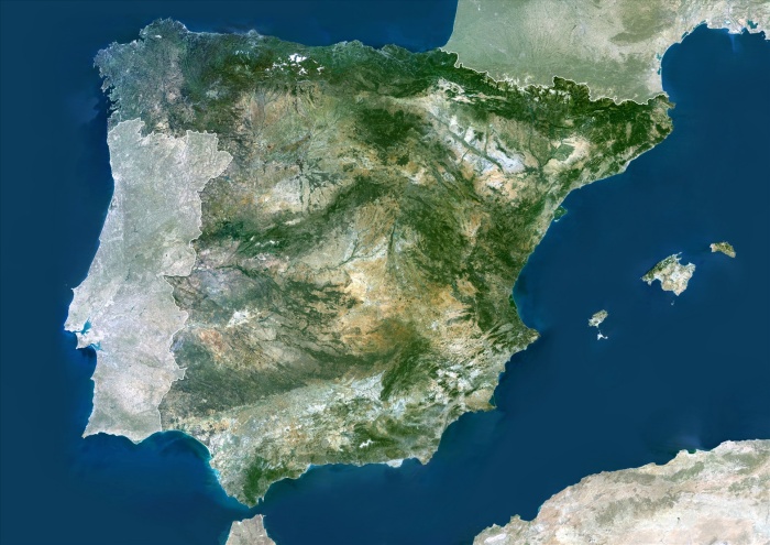
Spain, True Colour Satellite Image With Mask And Border. Spain, true colour satellite image with mask and border. Spain takes up the majority of the Iberian peninsula and includes the Balearic Islands (centre right). The southwestern section of the Iberian Peninsula is taken up by Portugal. From left to right, the Balearic Islands are Ibiza (with tiny Formentera below it), Majorca and Menorca. The southern tip of the Iberian peninsula forms the northern part of the Strait of Gibraltar, a narrow strait that separates the British Overseas Territory of Gibraltar from Morocco some 14 kilometres to the south. This strait is the only communication between the Atlantic Ocean (left) and the Mediterranean Sea (right). The image used data from LANDSAT 5 & 7 satellites.
| px | px | dpi | = | cm | x | cm | = | MB |
Details
Creative#:
TOP09062913
Source:
達志影像
Authorization Type:
RM
Release Information:
須由TPG 完整授權
Model Release:
NO
Property Release:
NO
Right to Privacy:
No
Same folder images:
 Loading