
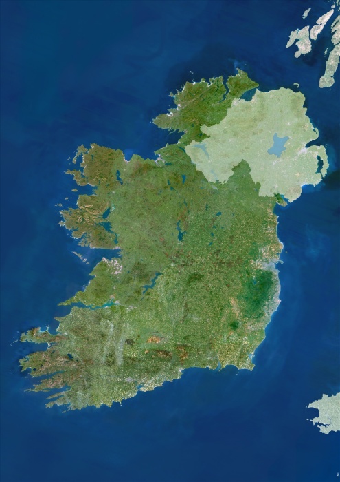
Ireland, True Colour Satellite Image With Mask. Ireland. True colour satellite image of Ireland, with mask. North is at top. The island's main cities are Dublin (centre right) and Belfast (upper right). Ireland is often called the "Emerald Isle" because of the vivid greenness of its countryside ; this is largely due to the warm, wet winds from the Atlan- tic Ocean to the West. Topographically, the island is shaped like a basin, having lowlands in its centre & hilly ranges around its coastline. Ireland has many lakes, including the largest in the British Isles, Lough Neagh (at upper right). The longest river in the British Isles, the Shannon, empties into a long, narrow estuary at lower left. Image taken by the Landsat-5 satellite.
| px | px | dpi | = | cm | x | cm | = | MB |
Details
Creative#:
TOP09061632
Source:
達志影像
Authorization Type:
RM
Release Information:
須由TPG 完整授權
Model Release:
NO
Property Release:
NO
Right to Privacy:
No
Same folder images:
 Loading