
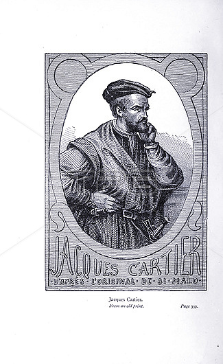
Illustration of Jacques Cartier (1491-1557), a French-Breton maritime explorer for France. Jacques Cartier was the first European to describe and map the Gulf of Saint Lawrence and the shores of the Saint Lawrence River, which he named 'The Country of Canadas' after the Iroquoian names for the two big settlements he saw at Stadacona (Quebec City) and at Hochelaga (Montreal Island). From The Exploration of the World, Celebrated Travels and Travellers, Celebrated Voyages' by Jules Verne. Published in three volumes from 1878 to 1880, Celebrated Travels and Travelers is a history of the explorers and adventurers who voyaged to the far reaches of the globe, discovered the wonders of exotic lands and filled in the blank spaces on the world map. With illustrations by L Benett and P Philippoteaux.
| px | px | dpi | = | cm | x | cm | = | MB |
Details
Creative#:
TPG34333337
Source:
達志影像
Authorization Type:
RF
Release Information:
須由TPG 完整授權
Model Release:
Not Available
Property Release:
Not Available
Right to Privacy:
No
Same folder images:
 Loading