
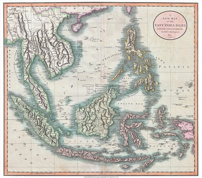
Map of mainland Southeast Asia including Burma / Myanmar, Lan Na (now Northern Thailand), Siam (Thailand), Laos, Cambodia, Vietnam, Champa, Malaya, Indonesia and the Philippines.
Pulau Pinang / Penang Island is shown as being British (1786), and the Paracels Islands (Vt. Ho?ng Sa, Ch. Xi Sha) are clearly shown as being Vietnamese.
| px | px | dpi | = | cm | x | cm | = | MB |
Details
Creative#:
TPG32671830
Source:
達志影像
Authorization Type:
RF
Release Information:
須由TPG 完整授權
Model Release:
No
Property Release:
No
Right to Privacy:
No
Same folder images:
 Loading