
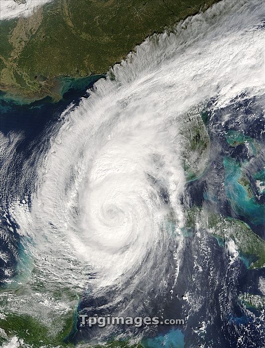
Hurricane Wilma. Terra satellite image of hurricane Wilma as it approaches Florida, USA (upper centre right), on 23 October 2005. Part of Wilma is over the western tip of Cuba (right), where heavy rains from the hurricane caused in coastal areas to flood. Mexico's Yucatan Peninsula is at lower left. At this point the hurricane had strengthened again to a category 3 storm. Wilma is the 21st named storm in the record-breaking 2005 Atlantic hurricane season and the 3rd category 5 hurricane. It also had the lowest central atmospheric pressure ever measured in the Atlantic basin, the pressure in the eye was just 882 millibars on 19 October.
| px | px | dpi | = | cm | x | cm | = | MB |
Details
Creative#:
TPG05323680
Source:
達志影像
Authorization Type:
RF
Release Information:
須由TPG 完整授權
Model Release:
NO
Property Release:
NO
Right to Privacy:
No
Same folder images:
 Loading