
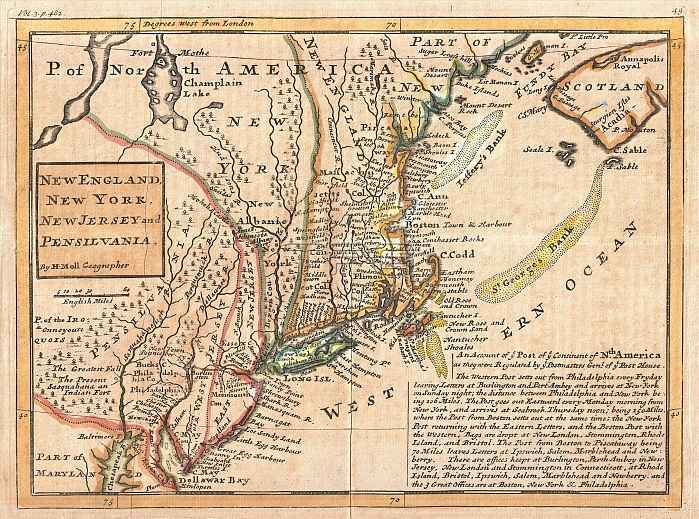
1729, Moll Map of New York, New England, and Pennsylvania, First Postal Map of New England
| px | px | dpi | = | cm | x | cm | = | MB |
Details
Creative#:
TOP29782114
Source:
達志影像
Authorization Type:
RM
Release Information:
須由TPG 完整授權
Model Release:
Not Available
Property Release:
Not Available
Right to Privacy:
No
Same folder images:
1729MollMapofNewYorkNewEnglandandPennsylvaniaFirstPostalMapofNewEnglandtopographycartographygeographylandillustrationgeographictraveltopochartgridlatitudelongitudegeometricatlasmapvintageancienthistoryworldpaperoldretroeartharthistoricaldecorativenavigationagedhistoricjourneydiscoveryexplorationgeographicalMappamundispaceregionoldmapantiquemaprareoldmapsoldantiqueplanolsantiquemapoldantiqueview
1729EnglandEnglandFirstMapMapMappaMollNewNewNewPennsylvaniaPostalYorkagedancientandantiqueantiqueantiqueantiqueartatlascartographychartdecorativediscoveryearthexplorationgeographicgeographicalgeographygeometricgridhistorichistoricalhistoryillustrationjourneylandlatitudelongitudemapmapmapmapmapsmundinavigationofofoldoldoldoldoldolspaperplanrareregionretrospacetopotopographytravelviewvintageworld
 Loading