
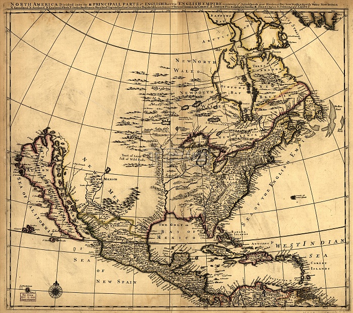
North America divided into its III principall [sic] parts, 1685. This map, North America Divided into its III Principal Parts, was created in the late 17th century and reflects the contemporary knowledge of North America and neighboring regions in the early colonial era. It was drafted in 1685 by the English cartographer Philip Lea, who made several maps of North America in the course of a career in which he produced a wide range of maps and atlases. Some parts of the map bear their modern names. Others have names that are colorfully descriptive, such as Tract of Land full of Wild Bulls," "Mission of ye Recollect or Upstart Franciscan Friars," and "Chooaskaby or Nation of Strong Men." The map contains the names of rivers, lakes, cities, colonies, mission sites, forts, Native American territories, and known mountain ranges. The map has grid lines but no scale."
| px | px | dpi | = | cm | x | cm | = | MB |
Details
Creative#:
TOP29694905
Source:
達志影像
Authorization Type:
RM
Release Information:
須由TPG 完整授權
Model Release:
Not Required
Property Release:
Not Required
Right to Privacy:
No
Same folder images:
 Loading