
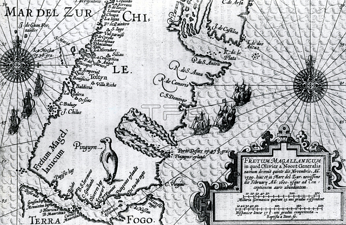
Map of the Strait of Magellan; plate from Oliver van Noort's description of his voyage; 1602 (engraving)
| px | px | dpi | = | cm | x | cm | = | MB |
Details
Creative#:
TOP29342285
Source:
達志影像
Authorization Type:
RM
Release Information:
須由TPG 完整授權
Model Release:
no
Property Release:
no
Right to Privacy:
No
Same folder images:
16thcentury16centuryXVIcenturyXVIthcenturysixteenthcenturyc16th1616thxvixvithcenturysecXVISouthAmericasouthamericanlatinamericaLatineAmericaAmerica(continent)explorationexploreexcursionexpeditionengravingengraverMagellanFerdinand(1480-1521)ferdinandmagellanMagellanFernand(Ferdinand)from(1480-1521)explorerexplorersPatagoniapatagonianpatagoniansPatagoniaPatagonianblackandwhiteblackandwhitemzengravingportolanmapmaps
(1480-1521)(1480-1521)(Ferdinand)(continent)161616th16thAmericaAmericaAmericaFerdinandFernandLatineMagellanMagellanPatagoniaPatagoniaPatagonianSouthXVIXVIXVIthamericaamericanandblackblackandwhitec16thcenturycenturycenturycenturycenturycenturyengraverengravingexcursionexpeditionexplorationexploreexplorerexplorersferdinandfromlatinmagellanmapmapsmzengravingpatagonianpatagoniansportolansecsixteenthsouthwhitexvixvith
 Loading