
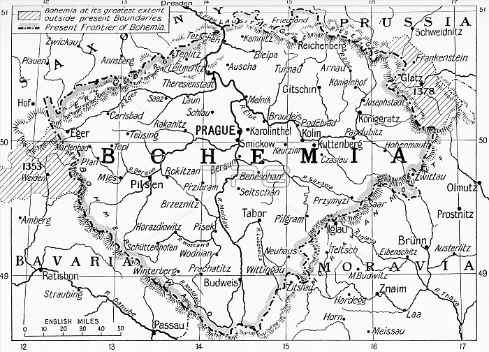
Map of Bohemia at the outbreak of WWI. The lined areas show its extent in the 14th century, the dotted line shows its frontier in 1914. From Hutchinson's History of the Nations, published 1915.
| px | px | dpi | = | cm | x | cm | = | MB |
Details
Creative#:
TOP29332578
Source:
達志影像
Authorization Type:
RM
Release Information:
須由TPG 完整授權
Model Release:
No
Property Release:
No
Right to Privacy:
No
Same folder images:
 Loading