
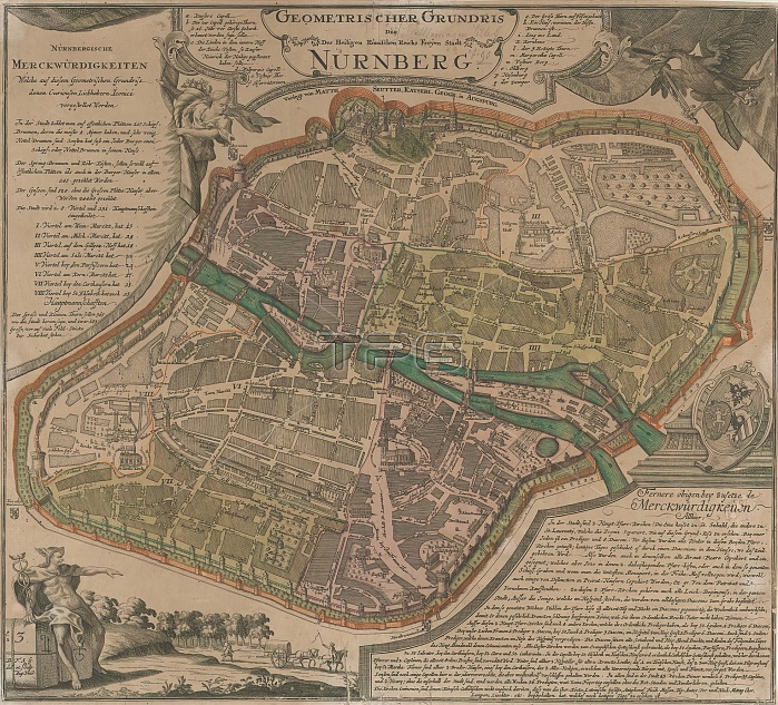
Map of Nuremberg, Geometrischer Grundris der des Heiligen Romischen Reichs Freyen Stadt Nurnburg (title on object), Map of Nuremberg, with the main buildings in bird's eye view. print maker: Monogrammist BFAG, (mentioned on object), after own design by: Monogrammist BFAG, (mentioned on object), publisher: Matthaeus Seutter (III), (mentioned on object), Augsburg, 1707 - 1757, paper, engraving, etching, height 534 mm x width 592 mm.
| px | px | dpi | = | cm | x | cm | = | MB |
Details
Creative#:
TOP28937923
Source:
達志影像
Authorization Type:
RM
Release Information:
須由TPG 完整授權
Model Release:
No
Property Release:
No
Right to Privacy:
No
Same folder images:
mapnuremberggeometrischergrundrisderdesheiligenromischenreichsfreyentitleobjectmapnurembergmainbuildingsbird'seyeviewprintmakermonogrammistbfagmentionedobjectowndesignmonogrammistbfagmentionedobjectpublishermatthaeusseutteriiimentionedobjectaugsburg17071757paperengravingetchingheight534mmxwidth592mm
53459217071757augsburgbfagbfagbird'sbuildingsderdesdesignengravingetchingeyefreyengeometrischergrundrisheightheiligeniiimainmakermapmapmatthaeusmentionedmentionedmentionedmmmmmonogrammistmonogrammistnurembergnurembergobjectobjectobjectobjectownpaperprintpublisherreichsromischenseuttertitleviewwidthx
 Loading