
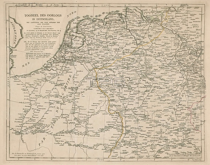
Map of Germany, Holland and Northern France, Tooneel des war in Duitschland (title on object), Map of Germany, Holland and Northern France, with the distance between the cities in hours. print maker: Willem Cornelis van Baarsel, (mentioned on object), publisher: Evert Maaskamp, (mentioned on object), Amsterdam, 1806 - 1813, paper, engraving, height 340 mm x width 426 mm.
| px | px | dpi | = | cm | x | cm | = | MB |
Details
Creative#:
TOP28937547
Source:
達志影像
Authorization Type:
RM
Release Information:
須由TPG 完整授權
Model Release:
No
Property Release:
No
Right to Privacy:
No
Same folder images:
 Loading