
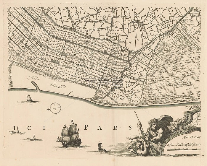
Map of Kennemerland and West-Friesland (fourteenth part), 't Hoogh-heemraetschap vande Uytwaterende Sluysen in Kennemerlandt en West-Frieslandt (title on object), Fourteenth part of a map of Kennemerland and West-Friesland. Numbered bottom right: 14. print maker: Coenraet Decker, print maker: Abraham Jansz. Deur, Jan Jansz. Dou (I), (mentioned on object), Amsterdam, 1680 - 1811, paper, engraving, height 446 mm x width 576 mm.
| px | px | dpi | = | cm | x | cm | = | MB |
Details
Creative#:
TOP28935928
Source:
達志影像
Authorization Type:
RM
Release Information:
須由TPG 完整授權
Model Release:
No
Property Release:
No
Right to Privacy:
No
Same folder images:
mapkennemerlandwest-frieslandfourteenthpart'thoogh-heemraetschapvandeuytwaterendesluysenkennemerlandtenwest-frieslandttitleobjectfourteenthpartmapkennemerlandwest-frieslandnumberedbottomright14printmakercoenraetdeckerprintmakerabrahamjanszdeurjanjanszdouimentionedobjectamsterdam16801811paperengravingheight446mmxwidth576mm
't1444657616801811abrahamamsterdambottomcoenraetdeckerdeurdouenengravingfourteenthfourteenthheighthoogh-heemraetschapijanjanszjanszkennemerlandkennemerlandkennemerlandtmakermakermapmapmentionedmmmmnumberedobjectobjectpaperpartpartprintprintrightsluysentitleuytwaterendevandewest-frieslandwest-frieslandwest-frieslandtwidthx
 Loading