
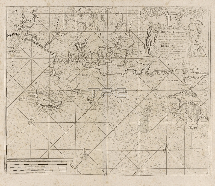
Passport card of the coast of France between the island of Groix and the municipality of La Baule-Escoublac New Pascaart From the coasts of Brittany Starting from t 'Incooms From the Loire river to t 'Eylandt de Groa / Carte Marine de la Costes de Bretagne de Commancement de la Rivierre de Loire Jus'qua Isle de Groa (title on object); Passport map of the coast of France from the Breton island of Groix to the municipality of La Baule -Escoublac in the region The Pays de la Loire; with Belle-蝜e-en-Mer; the largest Breton island in the Atlantic Ocean. With three compass roses. At the top center a stake with a detailed map of the mouth of the Blavet River into the Atlantic Ocean with Port Louis and 蝜e Saint-Michel. Top right a cartouche with the title and address of the publisher; flanked by a shepherdess; a putto and a woman with a trumpet. Below left the scale; shown in German; Spanish and English or French miles; cupids: 'amores'; 'amoretti'; 'putti'; sailing ship; sailing boat; herding; herdsman; herdswoman; shepherd; shepherdess; cowherd; etc; sheep; Brittany; Pays de la Loire; Belle 蝜e; Jan Luyken (rejected attribution); Amsterdam; 1681 - 1803; paper; etching; h 492 mm x w 601 mm
| px | px | dpi | = | cm | x | cm | = | MB |
Details
Creative#:
TOP28287154
Source:
達志影像
Authorization Type:
RM
Release Information:
須由TPG 完整授權
Model Release:
No
Property Release:
No
Right to Privacy:
No
Same folder images:
 Loading