
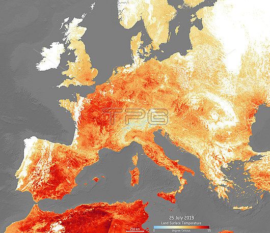
July 2019 European heat wave, satellite map. Land surface temperature map of Europe, the Mediterranean and North Africa on 25 July 2019, colour-coded from 55 degrees Celsius (red) through 25 degrees Celsius (yellow) to 0 degrees Celsius (light blue). Several countries in Europe saw record-breaking temperatures during this heatwave, which was caused by a large area of high pressure (a heat dome) over the region. The resulting disruption of the jet stream drew hot air north from the Sahara Desert. An increase in the number and severity of regional heatwaves has been linked with global warming. This image was produced using data from the Copernicus Sentinel-3's Sea and Land Surface Temperature Radiometer.
| px | px | dpi | = | cm | x | cm | = | MB |
Details
Creative#:
TOP27285849
Source:
達志影像
Authorization Type:
RM
Release Information:
須由TPG 完整授權
Model Release:
N/A
Property Release:
N/A
Right to Privacy:
No
Same folder images:
 Loading