
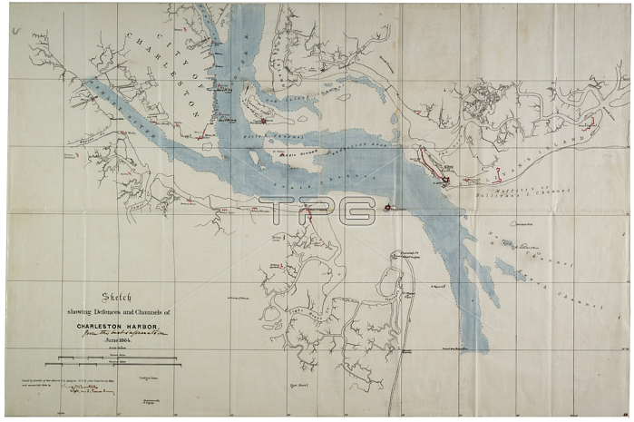
696119 Sketch showing defences and channels of Charleston Harbour, June 1864 (ink on oilcloth) by Bartelle, Charles V. (fl.1864); 37.3x56 cm; Gilder Lehrman Collection, New York, USA; (add.info.: States that the map has been, ""Copied by direction of Rear Admiral J. A. Dahlgren."" The water on the map has been hand-coloured. Signed ""[Charles V. Bartelle], Asst. U.S. Comm. Survey."" A note, ""from the best information,"" is handwritten underneath the title (apparently not in Bartelle\'s hand). John Adolphus Bernard Dahlgren (1809-1870).); 穢 Gilder Lehrman Institute of American History ; American, out of copyright.
| px | px | dpi | = | cm | x | cm | = | MB |
Details
Creative#:
TOP27138571
Source:
達志影像
Authorization Type:
RM
Release Information:
須由TPG 完整授權
Model Release:
No
Property Release:
No
Right to Privacy:
No
Same folder images:
 Loading