
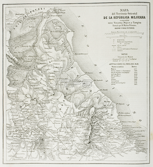
KW403239 Map of the eatern territories of the Republic of Mexico as they were in 1862, from \'The Universal Museum\', published 1862 (engraving) by Spanish School, (19th century); Private Collection; (add.info.: El Museo Universal;); Spanish, out of copyright.
| px | px | dpi | = | cm | x | cm | = | MB |
Details
Creative#:
TOP27056257
Source:
達志影像
Authorization Type:
RM
Release Information:
須由TPG 完整授權
Model Release:
No
Property Release:
No
Right to Privacy:
No
Same folder images:
coastcoastlineshorelineseamaritimecartographycentralamericacolonyhistoricallatinamericanlatinamericamexicanmappingcolonialmesoamericancentralamericaneastmesoamericahistoryveracruzcentralamericacolonyhistoricallatinamericanlatinamericamexicanmappingcolonialmesoamericancentralamericancoastaleastcoastmesoamericahistoryveracruz
americaamericaamericaamericaamericanamericanamericanamericancartographycentralcentralcentralcentralcoastcoastcoastalcoastlinecolonialcolonialcolonycolonyeasteasthistoricalhistoricalhistoryhistorylatinlatinlatinlatinmappingmappingmaritimemesoamericamesoamericamesoamericanmesoamericanmexicanmexicanseashorelineveracruzveracruz
 Loading