
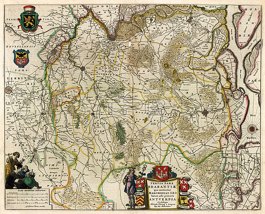
17th century illustrated map of Marquisate and Third District of Brabant. The Duchy of Brabant developed from the Landgraviate of Brabant and formed the heart of the historic Low Countries, part of the Burgundian Netherlands from 1430 and of the Habsburg Netherlands from 1482, until it was partitioned after the Dutch revolt. Today all the duchy's former territories, apart from exclaves, are in Belgium except for the Dutch province of North Brabant. Map from from 'Le theatre du monde' or 'Novvel atlas' (Amsterdam, 1647) by Dutch map-makers Willem Janszoon Blaeu (1571-1638) and Joan Blaeu (1596-1673).
| px | px | dpi | = | cm | x | cm | = | MB |
Details
Creative#:
TOP27005561
Source:
達志影像
Authorization Type:
RM
Release Information:
須由TPG 完整授權
Model Release:
N/A
Property Release:
N/A
Right to Privacy:
No
Same folder images:
 Loading