
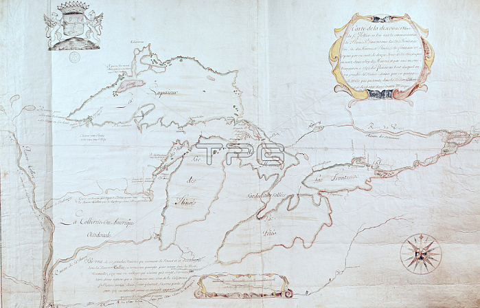
XIR214129 Map of the Great Lakes (pen & ink and w/c on paper) by Jolliet, (18th century); Service Historique de la Marine, Vincennes, France; (add.info.: map representing the Great Lakes;); French, out of copyright.
| px | px | dpi | = | cm | x | cm | = | MB |
Details
Creative#:
TOP26950502
Source:
達志影像
Authorization Type:
RM
Release Information:
須由TPG 完整授權
Model Release:
No
Property Release:
No
Right to Privacy:
No
Same folder images:
 Loading