
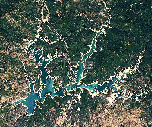
Satellite image of Shasta Lake, California, USA during a drought. Tan areas surrounding the water are part of the lakebed that would be underwater when the reservoir is closer to full capacity. Shasta Lake is the largest reservoir in California and a key water source for agricultural lands in the Central Valley. Image obtained by the Operational Landsat Imager (OLI) on the Landsat 8 satellite.
| px | px | dpi | = | cm | x | cm | = | MB |
Details
Creative#:
TOP26556382
Source:
達志影像
Authorization Type:
RM
Release Information:
須由TPG 完整授權
Model Release:
N/A
Property Release:
N/A
Right to Privacy:
No
Same folder images:
 Loading