
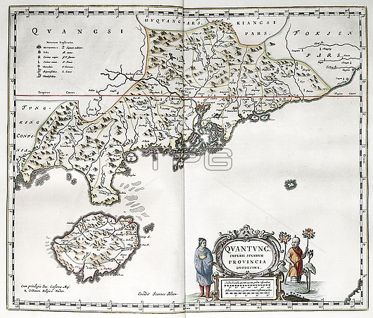
Map of Guangdong and Hainan in China, 17th century. The name of the imperial province is here given as 'Quantung'. The key at upper left indicates the size and type of settlements and military forts. The scale at lower right is in Chinese stadia and German miles. This map is from 'Novus atlas Sinensis' (1655) by Jesuit missionary and cartographer Martino Martini (1614-1661). This work was the most complete geographical description of China available to Europeans.
| px | px | dpi | = | cm | x | cm | = | MB |
Details
Creative#:
TOP26515759
Source:
達志影像
Authorization Type:
RM
Release Information:
須由TPG 完整授權
Model Release:
N/A
Property Release:
N/A
Right to Privacy:
No
Same folder images:
 Loading