
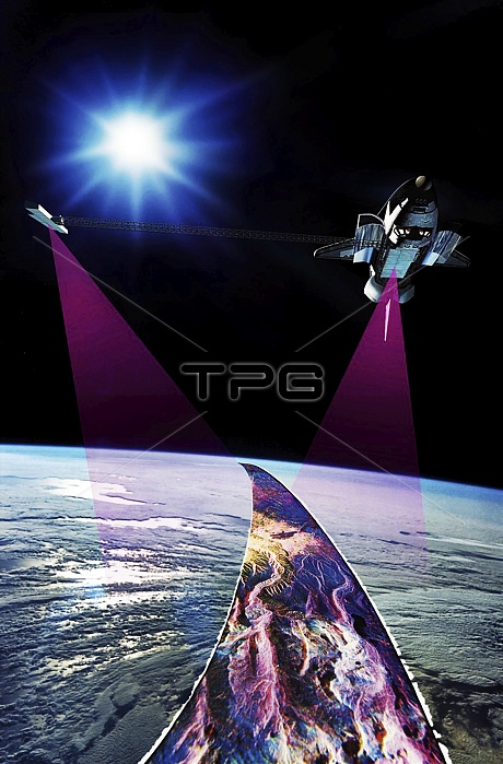
Shuttle Radar Topographic Mission, illustration. Launched on 11 February 2000, the STS-99 Shuttle Radar Topographic Mission (SRTM) was the most ambitious Earth mapping mission of its time. The Space Shuttle Endeavour orbited some 233 kilometres above the Earth. It used C-band and X-band outboard antennae, one located in the Shuttle bay and one on the end of a 60-metre deployable mast. The SRTM radar was able to penetrate clouds as well as provide its own illumination, independent of daylight, obtaining 3-dimensional topographic images of the world's surface up to the Arctic and Antarctic Circles. The mission completed 222 hours of continuous radar mapping.
| px | px | dpi | = | cm | x | cm | = | MB |
Details
Creative#:
TOP25499429
Source:
達志影像
Authorization Type:
RM
Release Information:
須由TPG 完整授權
Model Release:
N/A
Property Release:
N/A
Right to Privacy:
No
Same folder images:
 Loading