
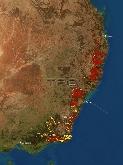
Eastern Australia bushfires, satellite map. This map shows active fires for 3 January 2020 (in yellow) and the cumulative burned area since 1 September 2019 (in red) across the Australian states of Queensland, New South Wales and Victoria, overlaid on a natural-colour, cloud-free satellite image. The major cities affected are labelled: Brisbane, Sydney, Canberra and Melbourne. A state of emergency was declared in New South Wales, with record-breaking temperatures and drought increasing the effect of the bushfires. The data is from the Visible Infrared Imaging Radiometer Suite (VIIRS) instrument on NOAA's Suomi satellite, and from NASA's Fire Information for Resource Management System (FIRMS).
| px | px | dpi | = | cm | x | cm | = | MB |
Details
Creative#:
TOP25477261
Source:
達志影像
Authorization Type:
RM
Release Information:
須由TPG 完整授權
Model Release:
N/A
Property Release:
N/A
Right to Privacy:
No
Same folder images:
 Loading