
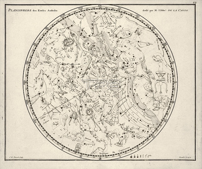
Southern constellations. 18th-century map of constellations and stars of the southern celestial hemisphere. The constellations are represented by artworks of their mythical namesakes. At lower right is a key for the magnitude (brightness) of the stars. This map was by the French astronomer Nicolas Louis de Lacaille (1713-1762), who studied the southern sky from the Cape of Good Hope, South Africa, mapping some 10,000 stars. This map appeared in both the 1776 and 1795 editions of Jean N. Fortin's 'Atlas Celeste de Flamsteed', a French edition of the posthumous 1729 atlas by British astronomer John Flamsteed (1646-1719).
| px | px | dpi | = | cm | x | cm | = | MB |
Details
Creative#:
TOP25419641
Source:
達志影像
Authorization Type:
RM
Release Information:
須由TPG 完整授權
Model Release:
N/A
Property Release:
N/A
Right to Privacy:
No
Same folder images:
 Loading