
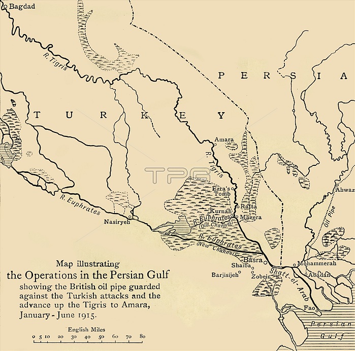
'Map illustrating the Operations in the Persian Gulf', First World War, 1915, (c1920). '...showing the British oil pipe guarded against the Turkish attacks and the advance up the Tigris to Amara, January - June 1915'. From "The Great World War - A History" Volume III, edited by Frank A Mumby. [The Gresham Publishing Company Ltd, London, c1920]
| px | px | dpi | = | cm | x | cm | = | MB |
Details
Creative#:
TOP24871526
Source:
達志影像
Authorization Type:
RM
Release Information:
須由TPG 完整授權
Model Release:
No
Property Release:
No
Right to Privacy:
No
Same folder images:
rivercoastAsiacoastalMiddleEastindustrycountrybookTurkeygeographyoilTurkishwarlocationcenturyIranfirstworldwarconceptPipelineoilpipelineoilindustryIraqPersianGulfWorldWarIWWIB/WPersiaWorldWarOne1910s20thcenturyThePrintCollector1stWorldWarEuphratesgeographicalfeatureTGNTigrisWW1BasraRiverTigrisTigrisrivermapRiverEuphratesUnknownKeystoneArchivestheatreofwarTheGreatWorldWar:AHistoryFrankArthurMumbyMumbyFrankArthurGreshamPublishingCompanyGreshamPublishingCoLtdfertilecrescent
1910s1st20thAArchivesArthurArthurAsiaB/WBasraCoCollectorCompanyEastEuphratesEuphratesFrankFrankGreatGreshamGreshamGulfHistoryIIranIraqKeystoneLtdMiddleMumbyMumbyOnePersiaPersianPipelinePrintPublishingPublishingRiverRiverTGNTheTheTigrisTigrisTigrisTurkeyTurkishUnknownWW1WWIWarWarWarWar:WorldWorldWorldWorldbookcenturycenturycoastcoastalconceptcountrycrescentfeaturefertilefirstgeographicalgeographyindustryindustrylocationmapofoiloiloilpipelineriverrivertheatrewarwarwarworld
 Loading