
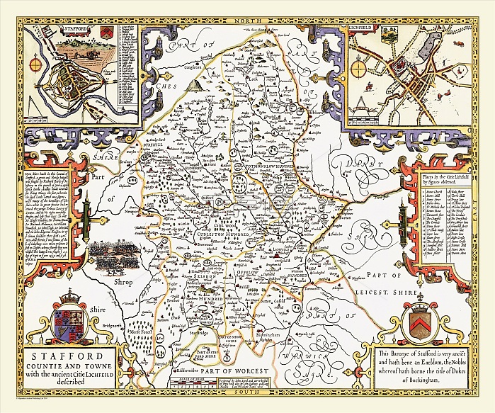
John Speed's county map of Staffordshire 1611 shows the county criss-crossed by the many tributaries of the River Trent. There were many estates and deer parks in the county and apart from the moorland area in the North there were also large tracts of woodland. There are bird?s eye views of Stafford and Lichfield in the top corners, each having its own legend. An illustration and description of a great battle at Blore Heath in 1495 is also shown to the left of the map. Other interesting details such as the ?Three Shires Stones? in the north of the county complement the artistic strapwork.
| px | px | dpi | = | cm | x | cm | = | MB |
Details
Creative#:
TOP23891745
Source:
達志影像
Authorization Type:
RM
Release Information:
須由TPG 完整授權
Model Release:
No
Property Release:
No
Right to Privacy:
No
Same folder images:
 Loading