
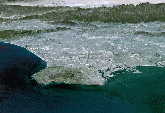
Colored three-dimensional computer map of Los Angeles, California. The land topography was mapped by the Shuttle Radar Topography Mission (SRTM) on the Space Shuttle Endeavour, using reflected radar pulses. Colours are from a Landsat 7 image. At lower left is the Palos Verdes Peninsula; to its right is Long Beach Harbour. At top are the San Gabriel Mountains (brown) and the Mojave Desert (white). The height of features is exaggerated 1.5 times in this image. SRTM was a joint mission of NASA, the USA's National Imagery and Mapping Agency (NIMA), and the German and Italian space agencies.
| px | px | dpi | = | cm | x | cm | = | MB |
Details
Creative#:
TOP22314391
Source:
達志影像
Authorization Type:
RM
Release Information:
須由TPG 完整授權
Model Release:
N/A
Property Release:
No
Right to Privacy:
No
Same folder images:
 Loading