
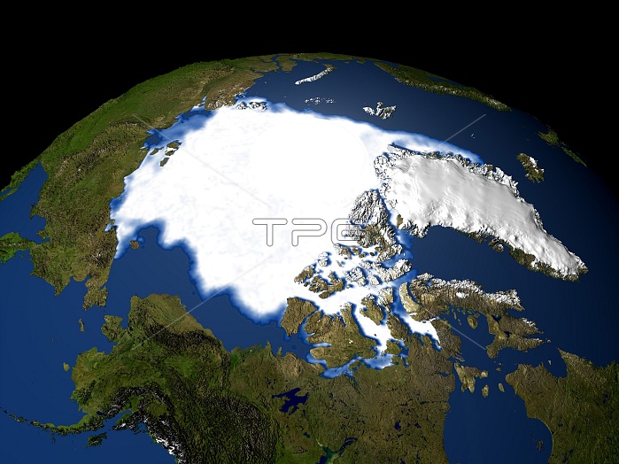
Satellite image of the Arctic Sea in 1979. Arctic perennial sea ice has been decreasing at a rate of 9 percent per decade since the 1970s. In this image ice covers much of the eastern coast of Greenland (center right) and touches the northern coast of eastern Russia (center left). Scientist and researchers suspect the loss of Arctic Sea ice may be caused by changing atmospheric pressure patterns over the Arctic that move sea ice around, and by warming Arctic temperatures that result from the buildup of greenhouse gases in the atmosphere. Data collected by the Special Sensor Microwave Imager (SSMI) on a Defense Meteorological Support Program (DMPS) satellite.
| px | px | dpi | = | cm | x | cm | = | MB |
Details
Creative#:
TOP22312715
Source:
達志影像
Authorization Type:
RM
Release Information:
須由TPG 完整授權
Model Release:
N/A
Property Release:
No
Right to Privacy:
No
Same folder images:
 Loading