
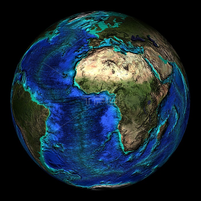
Topographical map of the Earth, centered on 0 degrees North, 0 degrees East. The major land mass here is Africa with most of the Atlantic Ocean showing as well. The seas and oceans are color-coded by depth and land colors are based on MODIS true-color data from the Terra satellite in 2004 where darker regions represent highlands. Turquoise regions represent the continental shelf and descend to around 150 meters before dropping off abruptly at the shelf break. The descent of the continental slope to the ocean floor is shown as increasingly dark shades of blue. Also shown is the mid-Atlantic Ridge, a huge submarine mountain chain that runs north-south the length of the Atlantic Ocean.
| px | px | dpi | = | cm | x | cm | = | MB |
Details
Creative#:
TOP22312434
Source:
達志影像
Authorization Type:
RM
Release Information:
須由TPG 完整授權
Model Release:
N/A
Property Release:
No
Right to Privacy:
No
Same folder images:
 Loading