
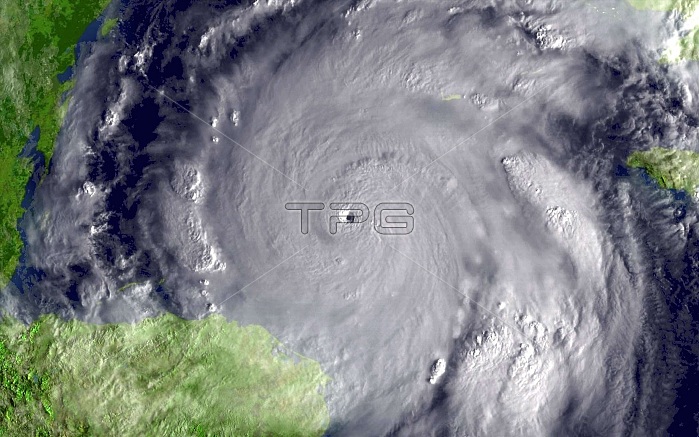
This image was taken by the GOES-12 satellite on October 19, 2005, as the storm approached Cancun and Cozumel, Mexico. Hurricane Wilma was the most intense tropical cyclone ever recorded in the Atlantic basin. Part of the record breaking 2005 Atlantic hurricane season, which included three of the six most intense Atlantic hurricanes ever (along with #4 Rita and #6 Katrina), Wilma was the 22nd storm, 13th hurricane, 6th major hurricane, 4th Category 5 hurricane, and 2nd most destructive hurricane of the 2005 season. A tropical depression formed in the Caribbean Sea near Jamaica on October 15, and intensified into a tropical storm two days later, which was named Wilma. After heading westward as a tropical depression, Wilma turned abruptly southward after becoming a tropical storm. Wilma continued intensifying, and eventually became a hurricane on October 18. Shortly thereafter, extreme intensification occurred, and in only 24 hours, Wilma became a Category 5 hurricane with winds of 185 mph. Wilma is ranked among the top five most costly hurricanes ever recorded in the Atlantic and the fifth costliest storm in United States history.
| px | px | dpi | = | cm | x | cm | = | MB |
Details
Creative#:
TOP22092803
Source:
達志影像
Authorization Type:
RM
Release Information:
須由TPG 完整授權
Model Release:
N/A
Property Release:
No
Right to Privacy:
No
Same folder images:
 Loading