
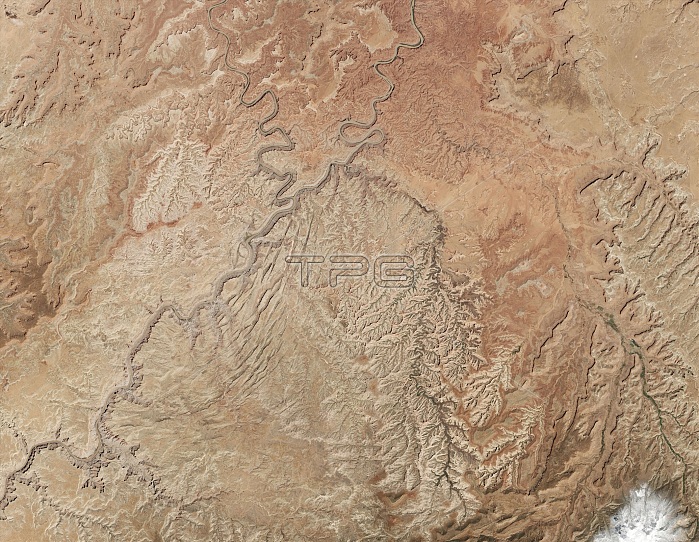
Meanders and oxbows along the Colorado River as captured by Landsat 8. "The Loop", visible as a double oxbow at the upper center of this image, is located in Canyonlands National Park about 5 miles upstream from the confluence of the Green and Colorado Rivers. Known as an 'entrenched meander' by geologists, the Loop's canyon walls are about 500 feet high, about the equivalent of a 50-story building. The lower canyon walls are part of the Hermosa Formation, a group of sedimentary rock layers that formed about 300 million years ago. At the narrowest point, just 500 feet of rock separate the channels of the East Loop; the slightly wider neck of the West Loop measures about 1,700 feet. As the Colorado River continues to erode the canyon wall, it will eventually punch through and create a new channel, leaving an oxbow lake and later a rincon.
| px | px | dpi | = | cm | x | cm | = | MB |
Details
Creative#:
TOP22092598
Source:
達志影像
Authorization Type:
RM
Release Information:
須由TPG 完整授權
Model Release:
No
Property Release:
No
Right to Privacy:
No
Same folder images:
 Loading