
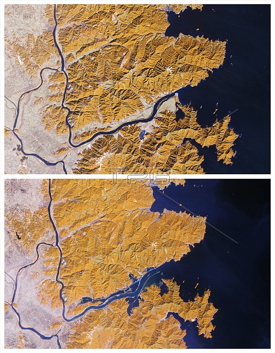
Color-enhanced satellite image of Japan's Kitakami River before (top) and three days after (bottom) the devastating earthquake and tsunami of March 11, 2011. Water (blue) has spilled over the banks both north and south of the river. Although agricultural fields (yellow) appear to have escaped the flooding farther inland, some fields closer to the ocean have seemingly disappeared into the sea. North of the Kitakami, floodwaters extend far enough inland to create what looks like a parallel river. Near the coast, only the rugged peaks rising above the floodplains have escaped inundation. Composite of BS0541 and BS0540.
| px | px | dpi | = | cm | x | cm | = | MB |
Details
Creative#:
TOP22089593
Source:
達志影像
Authorization Type:
RM
Release Information:
須由TPG 完整授權
Model Release:
N/A
Property Release:
No
Right to Privacy:
No
Same folder images:
 Loading