
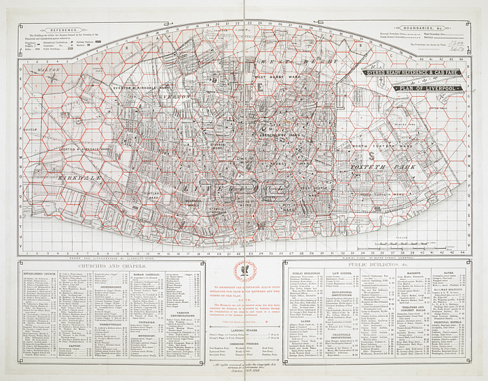
A cab-fare map of Liverpool which used a system of hexagons to enable distances- and fares- to be calculated.Liverpool; 1868.From: Syers's Ready Reference and Cab Fare Plan of Liverpool.Maps 3230. (13.)London; British Library.
| px | px | dpi | = | cm | x | cm | = | MB |
Details
Creative#:
TOP21015337
Source:
達志影像
Authorization Type:
RM
Release Information:
須由TPG 完整授權
Model Release:
No
Property Release:
No
Right to Privacy:
No
Same folder images:
Restriction:
Additional permissions needed for non-editorial use.
 Loading