
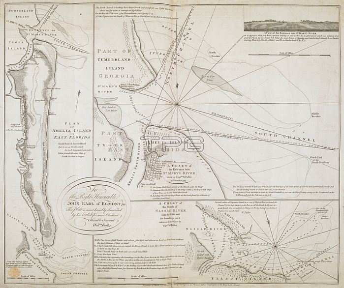
A chart of the entrance into Saint Mary's River.London: T. Jefferys; 1770.From: Thomas Fuller; A Chart of the Entrance into Saint Mary's River taken by Capt. W. Fuller. 1769. (Plan of Amelia Island. A Chart of the Mouth of Nassau River).Maps K. Top. 122.84London; British Library.
| px | px | dpi | = | cm | x | cm | = | MB |
Details
Creative#:
TOP21008869
Source:
達志影像
Authorization Type:
RM
Release Information:
須由TPG 完整授權
Model Release:
No
Property Release:
No
Right to Privacy:
No
Same folder images:
Restriction:
Additional permissions needed for non-editorial use.
 Loading