
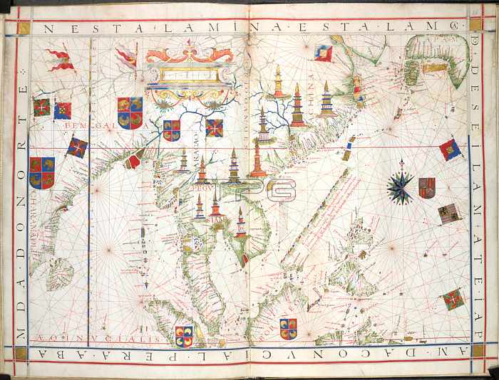
South China and East Indies; (Whole chart] Chart from the east coast of India; the Bay of Bengal and the Malay peninsula; to the coast of South China and Japan; with the East Indies including part of Sumatra; Borneo and MindanaoImage taken from Universalis Orbis Hydrographia.Originally published / produced in Portugal; 1573.Portugal; 1573.From: Universalis Orbis Hydrographia.Add. 31317; ff. 25v-26London; British Library.
| px | px | dpi | = | cm | x | cm | = | MB |
Details
Creative#:
TOP20534486
Source:
達志影像
Authorization Type:
RM
Release Information:
須由TPG 完整授權
Model Release:
No
Property Release:
No
Right to Privacy:
No
Same folder images:
Restriction:
Additional permissions needed for non-editorial use.
 Loading