
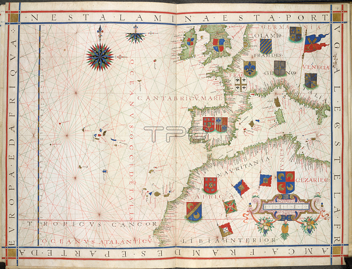
Chart of Western Europe; [Whole chart] Chart of Western Europe; from the British isles; the eastern Altlantic with the Canary islands and Azores; the Iberian peninsula and the western Mediterranean Sea to Italy; and the north west coast of Africa. Decoraed with heraldic coats of armsImage taken from Universalis Orbis Hydrographia.Originally published / produced in Portugal; 1573.Portugal; 1573.From: Universalis Orbis Hydrographia.Add. 31317; ff. 13v-14London; British Library.
| px | px | dpi | = | cm | x | cm | = | MB |
Details
Creative#:
TOP20495619
Source:
達志影像
Authorization Type:
RM
Release Information:
須由TPG 完整授權
Model Release:
No
Property Release:
No
Right to Privacy:
No
Same folder images:
Restriction:
Additional permissions needed for non-editorial use.
 Loading