
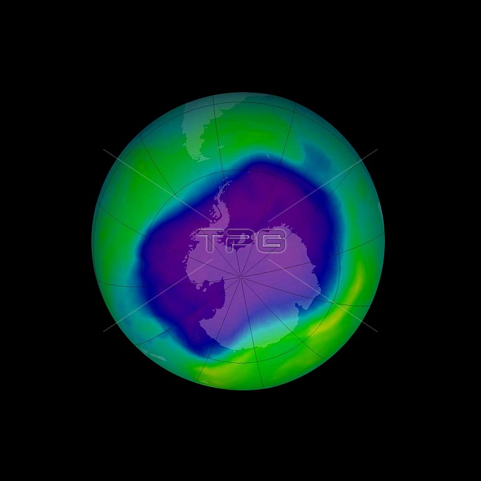
In this image, from September 2006, the Antarctic ozone hole was equal to the record single-day largest area of 11.4 million square miles (29.5 million square kilometres), reached on Sept. 9, 2000. Satellite instruments monitor the ozone layer, and we use their data to create the images that depict the amount of ozone. The blue and purple colours are where there is the least ozone, and the greens, yellows, and reds are where there is more ozone.
| px | px | dpi | = | cm | x | cm | = | MB |
Details
Creative#:
TOP20019451
Source:
達志影像
Authorization Type:
RM
Release Information:
須由TPG 完整授權
Model Release:
No
Property Release:
No
Right to Privacy:
No
Same folder images:
 Loading