
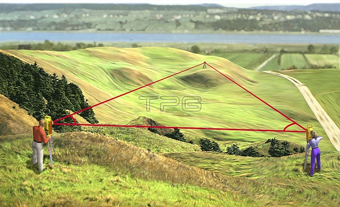
The first step in making a map is to precisely determine a number of points in the region being portrayed: this is called a survey. Measurements of the terrain are taken using a procedure called triangulation. After precisely determining the distance between two points, the cartographer chooses a third point and then measures the angles it forms with the base of the triangle. Trigonometric calculation is used to determine the lengths of the two other sides of the triangle. From point to point, a basic network is built from which the entire territory can be surveyed.
| px | px | dpi | = | cm | x | cm | = | MB |
Details
Creative#:
TOP19705871
Source:
達志影像
Authorization Type:
RM
Release Information:
須由TPG 完整授權
Model Release:
No
Property Release:
No
Right to Privacy:
No
Same folder images:
 Loading