
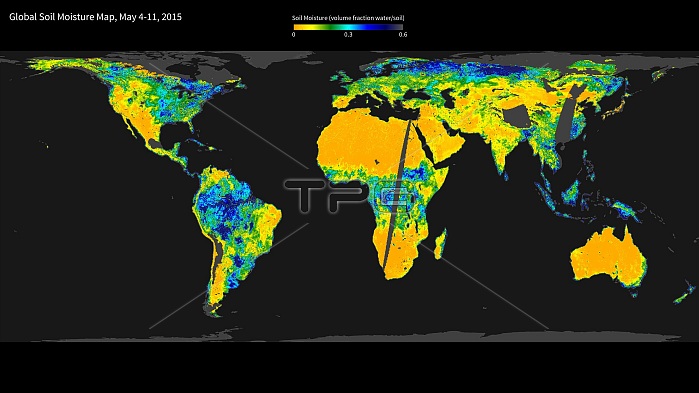
Global soil moisture. Satellite map showing the global variation in soil moisture, combining radar and radiometer sensor data. The moisture levels range from low (yellow) though green and light blue to high (green). The data is from the NASA satellite, the Soil Moisture Active Passive (SMAP) observatory. SMAP was launched on 31 January 2015, and these results from 4-11 May 2015 were among the first results from its observations. SMAP will combine two different sensor modes (radar and radiometer) to produce a combined soil moisture measurement. For the first radiometer map, see C032/1706. For the first radar map, see C032/1707.
| px | px | dpi | = | cm | x | cm | = | MB |
Details
Creative#:
TOP19534286
Source:
達志影像
Authorization Type:
RM
Release Information:
須由TPG 完整授權
Model Release:
N/A
Property Release:
N/A
Right to Privacy:
No
Same folder images:
 Loading