
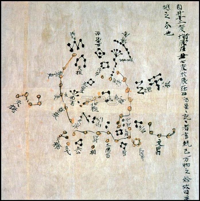
The Dunhuang map or Dunhuang Star map is one of the first known graphical representations of stars from ancient Chinese astronomy; dated to the Tang Dynasty (618-907). Before this map; much of the star information mentioned in historical Chinese texts had been questioned.
The map provides a graphical verification of the star observations; and are part of a series of pictures on one of the Dunhuang manuscripts. The Dunhuang Star map is to date the world's oldest complete preserved star atlas. Pictures From History
| px | px | dpi | = | cm | x | cm | = | MB |
Details
Creative#:
TOP19387879
Source:
達志影像
Authorization Type:
RM
Release Information:
須由TPG 完整授權
Model Release:
No
Property Release:
No
Right to Privacy:
No
Same folder images:
 Loading