
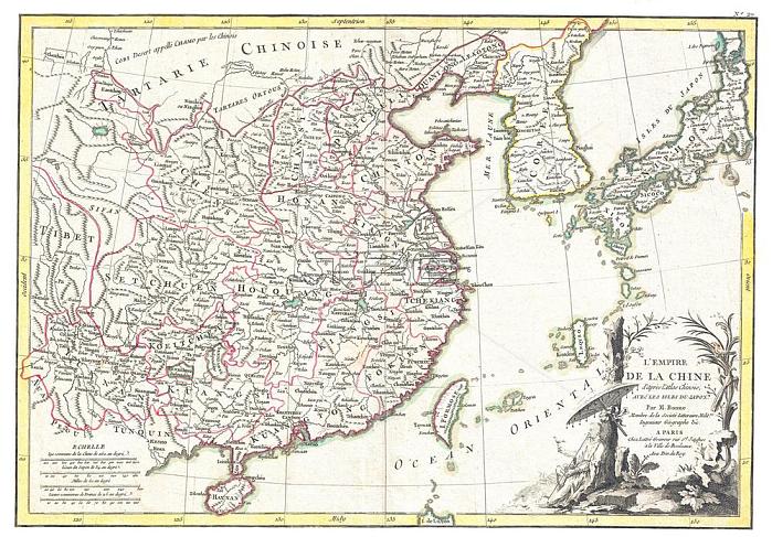
Rigobert Bonne's decorative map of China; Korea (Corea); Japan and Formosa (Taiwan). The arera covered extends from Tibet and Chinese Tartary east to Japan and south to Hainan.
China is divided into various provinces with major cities; lakes; and riverways noted. Names Macao; Canton; Nanking (Nanjing); Jedo (Tokyo); Peking (Beijing) and many other cities.
The lower right quadrant is decorated with an elaborate title cartouche showing a Chinese scholar or monk relaxing with a bird in a forest under a parasol. Drawn by R. Bonne c. 1770 for issue as plate no. 35 in Jean Lattre's 1776 issue of the Atlas Moderne . Pictures From History
| px | px | dpi | = | cm | x | cm | = | MB |
Details
Creative#:
TOP19387479
Source:
達志影像
Authorization Type:
RM
Release Information:
須由TPG 完整授權
Model Release:
No
Property Release:
No
Right to Privacy:
No
Same folder images:
 Loading