
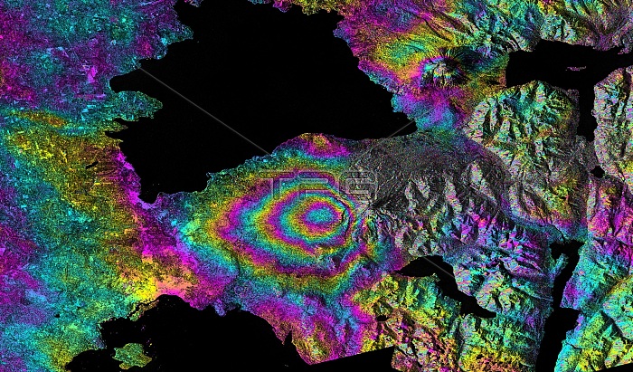
Calbuco volcano eruption. Satellite interferometric synthetic aperture radar (SAR) image of the Calbuco stratovolcano, Chile, during an eruption. Between 22nd to 23rd April 2015 significant explosive eruptions occurred at this volcano, the fist eruptive activity here since 1972. This image shows the relative deformation of the Earth's surface caused by eruption. The concentric leaf-shaped pattern of fringes (colour cycles) lies to the west of Calbuco volcano and represents subsidence of the ground surface due to deflation of a buried magma reservoir. Water is black. Lago Llanquihue (black, top) and Puerto Montt Bay (Pacific Ocean, black bottom) are also shown. Imaged by the C-band SAR sensor on the European Space Agency's (ESA) Sentinel-1 satellite, on
| px | px | dpi | = | cm | x | cm | = | MB |
Details
Creative#:
TOP16631880
Source:
達志影像
Authorization Type:
RM
Release Information:
須由TPG 完整授權
Model Release:
N/A
Property Release:
N/A
Right to Privacy:
No
Same folder images:
 Loading