
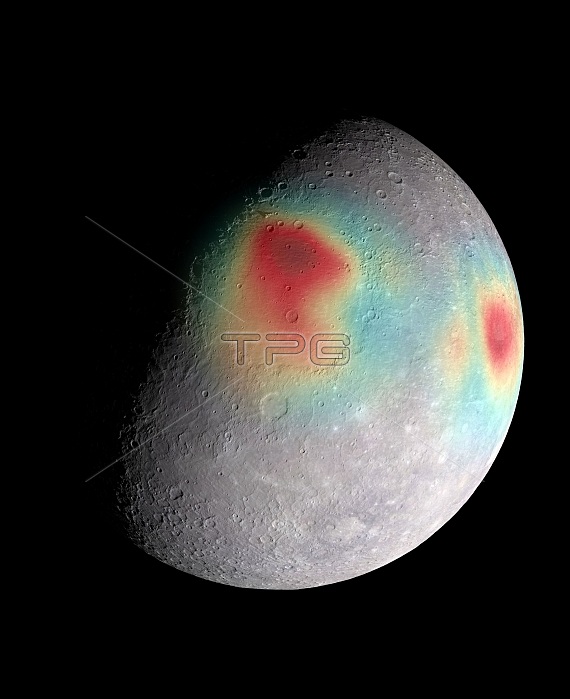
Mercury's gravity field. Composite satellite image showing a colour-coded map of Mercury's gravity anomalies. Red tones indicate mass concentrations, centred on the Caloris basin (centre) and the Sobkou region (right). Such large-scale gravitational anomalies are signatures of subsurface structure and evolution. The north pole is near the top of the sunlit area in this view. This image was created by combining radio tracking data overlaid on a mosaic image obtained by the Mercury Dual Imaging System (MDIS) on NASA's MESSENGER spacecraft and illuminated with a shape model determined from stereo-photoclinometry.
| px | px | dpi | = | cm | x | cm | = | MB |
Details
Creative#:
TOP16631868
Source:
達志影像
Authorization Type:
RM
Release Information:
須由TPG 完整授權
Model Release:
N/A
Property Release:
N/A
Right to Privacy:
No
Same folder images:
 Loading