
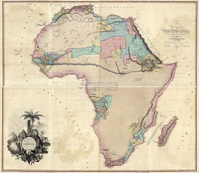
Map of Africa. 19th-century map of the continent of Africa, published in London in 1802 by British cartographer Aaron Arrowsmith (1750-1823). He addressed the map to the African Association (founded 1788), which promoted the discovery of the interior of Africa. The known areas are coloured and named, but large areas of the interior remained unmapped until the second half of the 19th century. The areas mapped are the coast of North Africa, north-eastern Africa, the Niger River, the mouth of the Congo River, and an area by the Mozambique Channel. The coast, shaded pink, had been mapped centuries earlier by the Portuguese.
| px | px | dpi | = | cm | x | cm | = | MB |
Details
Creative#:
TOP16426656
Source:
達志影像
Authorization Type:
RM
Release Information:
須由TPG 完整授權
Model Release:
N/A
Property Release:
N/A
Right to Privacy:
No
Same folder images:
 Loading